 Legendary Dartmoor The many aspects past and present of Dartmoor

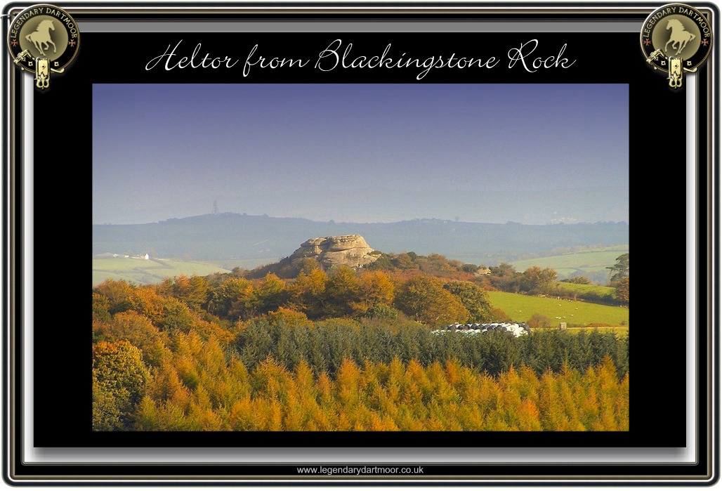
‘Blackingstone Rock or Blackystone, as it is always called… Being well placed, and having an elevation considerably over 1,000 feet, this pile forms another point from which a magnificent view is obtained. Like Hel Tor it is seen for many miles around, but according to tradition there was a time when these tors were not seen at all.’
William Crossing, 1990, p. 268.
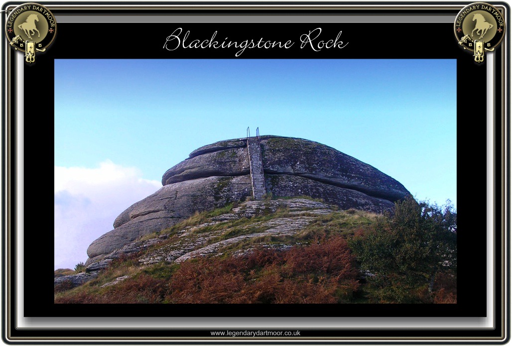
Drive along the narrow lane that runs up past Kennick Reservoir and you will eventually spot a huge, Christmas pudding-like outcrop of rock looming out of the hedge. Shortly after this first sighting one of those hideously coloured tourist signs will tell you that it is Blackingstone Rock. You will then be invited to drive further on down to a car park from where a short walk will take you to the rock. This outcrop appears like a single huge boil protruding from the landscape, nowhere in its vicinity are there any obvious signs of any other rocks, a real ‘Billy No Mates’ of the geological world. For many, many years Blackingstone Rock has been a place of pilgrimage for the discerning visitor. As William Crossing notes above, the views from the summit of the rock a far reaching in all directions and on a fine, clear day well worth the visit. As you walk along the footpath that runs along the southern base of the formation you will wonder how on earth one gets to the top without the aid of ropes and crampons. You will also note the lone holly tree that has made its home in one of the huge, eroded joins of the rock, in winter this can be a grand sight when its flecked with crimson berries. As you round the eastern side of the tor you will breath a sigh of relief when you spot the hand rail and flight of steps cut into the rock. Believe me, the short climb is well worth the energy for as you step onto the summit you will be surrounded by a yawning vista all across Devon. At your feet lie numerous rock basins which will testify that what nature can create so can it destroy, no doubt a couple of hundreds years ago these basins would have been deemed to play a role in mysterious rites of the Druids. As a tors go, Blackingstone Rock can be said to be among the highest as it stands about 24 metres from its base which is the tallest of the Dartmoor tors. In 1811 the Trigonometrical Survey by William Mudge was published and Blackingstone Rock was one of the stations used with Little Haldon, Rippon Tor old and new stations and Mardon Down acting as intersecting objects. On several occasions due to the rock’s predominance it has formed part of a beacon chain such as in 1897 on Queen Victoria’s diamond jubilee day . Due to the formation and height of Blackingstone Rock it does make for some decent rock climbs. According to what has become the ‘bible’ of Dartmoor rock climbing there are five climbs on the south face and three on the north. These have been given names as evocative as ‘Scruttock’s Old Dirigible’ and ‘Green Lipped Chasm’, (White, 1995, pp. 253 – 254). Some will say that the rock can also carry the accolade of being the most easterly tor, sadly Hel Tor can take that title by about 0.87 of a mile. What Blackingstone Rock can boast is the presence of particularly large crystals the mineral Feldspar with some examples being several centimetres long, this along with it’s typical tor jointing has led to it being classified as a R.I.G.S. (Regionally Important Geological Site), to be precise it is RIGS number 66 in the Devon Rigs Group listing. The actual site upon which Blackingstone stands was once part of the Torquay Corporations watershed properties associated with the nearby Kennick, Tottiford and Trenchford reservoirs which supplied the Torbay area with water. In 1981 the Dartmoor National Park Authority purchased the land and to mark the park’s 60th anniversary engraved “D.N.P, 60, 1951 -2011 on the rock face just below the steps.
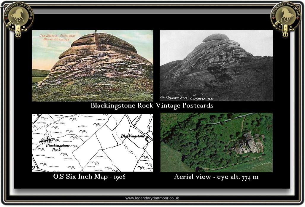
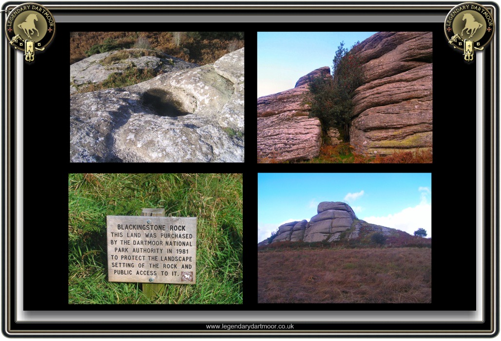
From the late 1800s Blackingstone Rock became a favourite tourist spot, mostly due to the aforementioned wide ranging views afforded from its summit. It did not take long for local businessmen to organise charabanc trips which included the Rock in their itinerary. In 1888 Mr. Jolls of Bovey Tracey included such an excursion which took visitors around the Lustleigh Valley, onto Moretonhampstead, then Blackingstone rock, the Torquay Reservoirs, Canonteign and the lower Teign Valley. By the early 1900s various tour businesses linked up with the local train services where excursions would be arranged around the arrival time of the trains. Once such was provided by a Mr. Davies who met the passengers at Christow and then took them on a tour visiting Dunsford, Steps Bridge, Blackingstone Rock and the Torquay Reservoirs. As noted above the lanes around Blackingstone Rock are quite narrow so imagine during the summer months the chaos that occurred with carriages, carts etc trying to pass each other. In the May of 1889 one such passenger noted the following; “As we ascend the hill, we unexpectantly confront a wagon on the road. There is a halt, in order to consult the likeliest means of passing in so a narrow lane. A course is decided upon, the wagon backed into a hedge as far as it would go, we do the same on the opposite side, and we get past, after colliding forcibly enough for us to wonder whether our wheel is off. It is not, however, so on we go and overtake a stupid old cow, that gallops before us, until with a leap it dashes through the hedge, and bounds homeward through the fields.” – The Torquay Times, May 24th, 1889. Not only were visitors transported to the rock by means of charabancs, carriages etc. but others simply included it on the hiking route. In 1890 one party of visitors from London wrote the following account of their visit to the rock; ” At length we descended the hill-brow, and hastened across a turnip field, for the Blackingstone Rock. When midway upon our journey we were discovered by sportsmen. They shouted to us with leather-tongued – “Hi!” and “Hey!” to “get out o’ they fields;” but we pretended to be deaf, and left them behind, to shout – and, if so disposed, to shoot to their heart’s content. Having regained the highway, it was not long before we were abreast of the rock, and were mounting its hoary, fissured sides. Unmistakable signs of civilisation lay scattered about the base of the narrow steps and the top of the rock, in the shape of a sprinkling of turnip peelings, which must have been quite recently strewn by a hand of explorers, doubtless Cockneys like ourselves, for who but a Londoner would eat that vegetable raw? Alas! for the omnivorous appetite of hunger; without a blush, we “went and di likewise,” and uprooting a turnip apiece we ascended the Rock, adding to the abundance of our predecessors peelings.” – The Torquay Times, January 3rd, 1890. One visitor to the rock has a fortunate escape in 1931 – “August 1931 – A young man named Mitchell, living in St. Thomas’s, Exeter, narrowly escaped serious injury on Saturday afternoon. He and a companion had climbed to the top of Blackingstone Rock, near Moretonhampstead, and Mitchell was sitting down, when he was seen to slide down the face of the rock on his back. He landed in some bracken, and escaped with minor injuries. His friend motored into Moretonhampstead for a doctor, who found him to be suffering from shock and bruising. He was later taken to his home in a car.” – The Exeter & Plymouth Gazette. The rock was purchased by the Dartmoor National Park Authority in 1981 in order to ‘protect the landscape setting of the rock‘ and also to ensure that there would always be public access.
But how did this huge outcrop come to be? William Crossing suggests that it was because one day long ago, King Arthur and the Devil were having a slight disagreement. King Arthur took his stand on the hill where the Blackingstone now stands and the Devil ensconced himself on the hill where Hel Tor is today. It was decided that the best way to settle this dispute was by hurling a mighty quoit at each other and without a second thought the contest was began. As the quoits hit the ground they immediately turned to stone thus today we have Blackingstone Rock and Hel Tor. It is interesting to note that Hel Tor lies 1.2 miles to the north east of Blackingstone which considering the size of the respective rocks would suggest they both ate three Weetabix for breakfast that morning. Another legend that is associated with Blackingstone Rock is the tale of the Blackingstone Ravens which can be found – HERE. Sometime in the late 1800s it was known locally that a pair of ravens actually did nest on the Rock but by 1896 that had vanished. Finally and again associated with Celtic mythology a smaller rock pile to the east of the Blackingstone is known as the ‘Druids Altar’.
In the October of 1833 Blackingstone Rock was the scene of a suspected murder. A local farmer had traveled to Chagford with load of wool which he had sold to a manufacturer there. On his way home it was possibly thought that he had met someone near to the rock and was then later found dead. It was some cattle drovers who first discovered the farmer’s horse and cart just standing in the road and then spotted the body. At first they either thought the man was asleep or drunk but when they could not rouse him it became obvious he was dead. At the inquest it was noted that the farmer had been paid for his wool on the previous day and as his fob watch and three sovereigns were found about his person it was deemed that highway robbery was not the cause of death. The puzzling factor was that there were no marks in the road suggesting he had fallen from the cart and there was no sign of a scuffle. The jury arrived at an open verdict
So, whether you want to climb Blackingstone Rock via ‘Scruttock’s Old Original’ route or ascend by the conventional steps it will be extremely rewarding, especially on a clear day. It can be found at Ordnance Survey grid reference SX 78645 85601.

Crossing, W. 1990. Crossing’s Guide to Dartmoor, Newton Abbot: Peninsula Press.
White, N. 1995. A Climbers Guide to South Devon & Dartmoor, Leicester: Cordee Publishing.
I walked up here last night. What a place! The views were utterly breath taking!
Am interested to know who built the steps and why? I can’t find any information on this other than the steps were erected in 1870.