 Legendary Dartmoor The many aspects past and present of Dartmoor


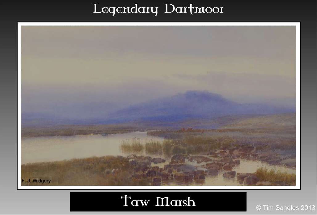
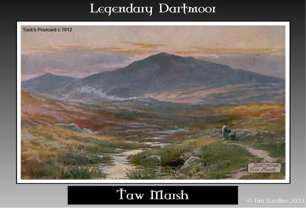
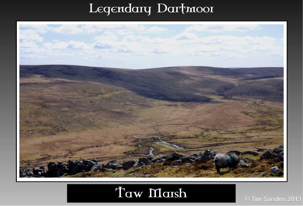
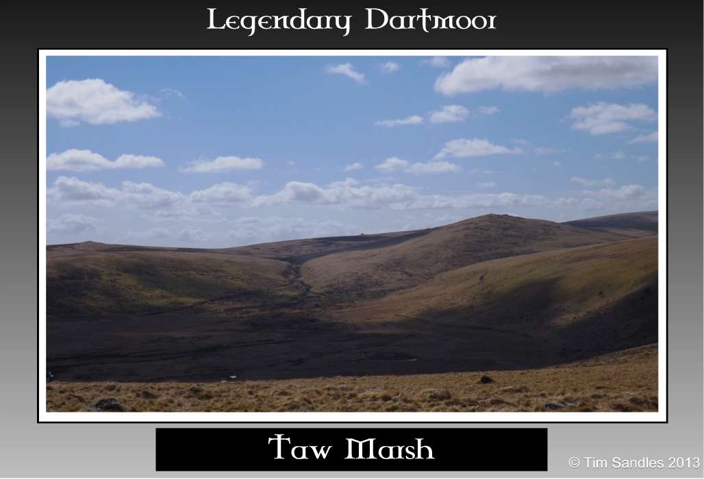
“A rugged path through broken ground, high above the river’s western bank leads to Taw Marsh, a plain of considerable extent, and remarkably level, dotted with masses of granite and surrounded by lofty eminences, with all the features and incidents characteristic of the peculiar scenery of the moor. Here is one of the spots where the evidence of some mighty convulsion of nature strike the the beholder with astonishment and carry irresistible conviction to the mind.”, Rowe, p.84.
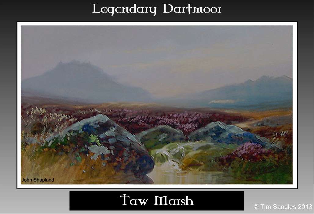
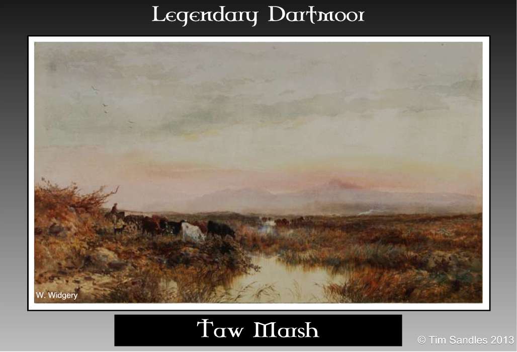
To be honest, I think Samuel Rowe could be exaggerating somewhat with the above description of Taw Marsh or to be exact – Taw Plain. When seen from one of its surrounding lofty heights there can be no argument that it’s flat and that there is a fair scattering of rocks but as to it striking ‘the beholder with astonishment‘ I’m not so sure. However, having said that numerous notable artists such as the two Widgerys, John Shapland etc. saw something that they wanted on canvas – beauty is in the eye of the beholder. Taw Marsh has also appeared as a location in various works of Dartmoor literature, Eden Phillpotts has used it and the surrounds in; The Secret Woman, The Beacon and Children of the Mist.
One of the earlier and complete printed studies of Taw Marsh was a survey conducted by Arthur Prowse which was published in the Transactions of the Devonshire Association in 1890. He succinctly described the landscape thus:
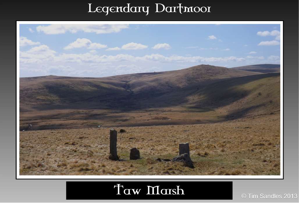
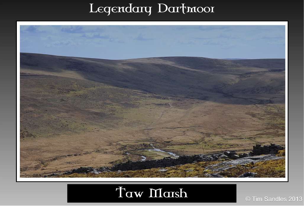
“Taw Marsh consists of two large stretches of bog, each about one-third of a mile long, and from one to two hundred yards broad, separated by a strip of firmer ground through which runs a small tributary of the Taw – Methral Brook. The bog is at the northern broad end of a pyriform (pear shaped) open valley, about 1200 feet above sea level, extending from Steeperton Tor on the south to the foot of Belstone Tors and Cosdon on the north.”, p.185.
But how was the plain formed in the first place? Back in the early 1900s Baring Gould suggested that originally it was a lake that later silted up due to deposits brought down by the various streams, p.147. Another fairly recent theory is that it was a lake formed as the result of glaciation and was first muted by Pickard and more recently expounded by Evans et. al:
“Pickard regarded the silty fill of Taw Marsh to be the deposits of a former lake dammed by a barrier of bouldery drift across the narrowest part of the valley below Belstone Common. An extensive and wide drift bench at 360-365m skirts most of the Taw Marsh depression and represents the upper level of the silty fill. Both sets of lateral drift hummocks and ridges converge on the valley narrowing below Belstone Common, indicative of a latero-frontal moraine arc that could have produced a moraine-dammed lake.”, Evans et. al. sn. 350-355.
There is also evidence that at one time groves of wood grew in the vicinity of the plain, a fact borne out by the discovery of branches, trunks and roots found deep down in the surrounding peat deposits. According to Rowe these consisted mainly of birch and oak woods, p.85. So now one can imagine a lake encompassed by groves of oak and birch all of which were surrounded by the guardian tors high above on the ridges.
There can be no question that the footprint of man has firmly been placed around Taw Marsh for a very, very long time as the discovery of nine Mesolithic flints (Pastscape Monument No. 444203) were once discovered here – now lodged with the Exeter Museum. This discovery would place man in the marsh anywhere from about 8,500BC right up to the present day and each era has left some kind of mark on the surrounding landscape. If you visit the Pastscape website and do a 1 kilometre location search for grid reference SX 620 910 it will return results which range from Bronze Age hut circles, cairns, a stone row (?), reaves, through to medieval blowing house streamworks and post medieval shooting stands, all in the vicinity of the marsh.
 |
 |
 |
 |
 |
 |
 |
 |
 |
The above landscape features do not include any of the modern ‘furniture’ related to water extraction which since the old tinner’s times has been exploited for power and various domestic uses. Now, it does not take much working out that if at one time Taw Plain was a lake but is no longer such the waters which still flow into the area must go somewhere. In 1878 the Dartmoor and Exeter Water Company proposed a bill to Parliament which would involve two dams at Taw Marsh along with a subterranean aqueduct which contoured around Cosdon thus providing Exeter with drinking water. This proposal came to naught and the marsh was left in peace for a while. In 1920 the Dartmoor & District Hydro Electricity Company proposed a series of twelve reservoirs along with power stations, canals etc all strategically located around Dartmoor – Taw Marsh being one of the twelve. Out of the dozen locations proposed only one at Mary Tavy actually went ahead, the rest involved in the plan were refused by the House of Lords thanks to local campaigning. In 1936 another company; South West Utilities Ltd attempted to obtain permission for both a water supply and hydro scheme which once again would involve a reservoir along with various canals. The reservoir was to have covered around 385 acres with the canal system running on the western side of the Oke Tor ridge. In true tradition this scheme was rejected by the House of Lords in 1937 which as local tradition has it was a good thing as in the Second World War a number of enemy bombs were dropped into the Marsh. This could have been a serious problem had the reservoir been built for the villages located downstream – the reverse effect of the bombing raids on the various dams situated along the Ruhr.
For some strange reason (profit and exploitation) numerous interested companies would just not let go of the idea that Taw Marsh could be exploited and in 1957 another company, the North Devon Water Board obtained permission to sink a number of test bore holes to ascertain the viability of water extraction. These explorations led to the 1959 North Devon Water Act in which permission was given to extract supplies from Taw Marsh. Simples, well not quite, because the widespread occurrence of granite in the area meant the water was found to be radioactive thanks to the radon association with granite. Ooops, and the sting in the tail was that this dire warning had been made crystal clear by various objecting parties prior to the permission to extract was given. However, not to be distracted the water company installed an aeration tank in order to remove the radon and carbon dioxide along with a treatment works. Nine wells were consequently sunk along with the underground aeration and balancing tanks near to the Irishman’s Wall at a cost of around £52,000. A compensation control house and gauging station was also constructed, the purpose of this was to ensure that the permitted agreed levels of flow were maintained after the allowed 2.5 million gallons of water per day were taken. A treatment works along with a supervisor’s cottage and a two million gallon underground reservoir were built just by the moorgate at Tongue End. A monumental stone now stands outside the treatment work commemorating Major Ormsby Allusen who was the chairman of the North Devon Water Board from 1945 – 1963 as can be seen from the photograph opposite. Incidentally the Latin inscription; “Si monumentum requiris circumspice,” translates as; “if you seek a monument, look around you“. He is credited with bringing; “the benefits of a pure and wholesome supply of piped water to many thousands of houses and farms in the area.” Apparently what he did not know was that compared to today’s standards the, “wholesome water supply,” was too high in aluminium content. A fact that the later owners, South West Water, recognised in the late 1990s and consequently stopped drawing water from Taw Marsh, Walpole, pp.132-134.
The cumulative result of the water extraction has been that over the years the groundwater levels in the marsh and in the actual river had reduced which in turn has lead to a large amount of environmental damage, a concern raised by both English Nature and the Dartmoor National Park Authority. A study carried out in the early 1990s revealed that the marsh was drying out which was drastically affecting the habitat of the native brown trout numbers. The quandary that the Environment Agency were presented with was how to improve the natural habitat of the marsh whilst maintaining the public water supply. The solution was to grant South West Water permission to extract water from the River Exe in return for them not extracting water from the marsh for the period between 1997 to 2000. At the time South West Water insisted on keeping the nine bore holes in the event that they were ever needed again. In 1989 the construction of Roadford Reservoir meant that this water supply could replace the demand of that from Taw Marsh which kind of made the above agreement pointless. Finally the poor old marsh could relax as it was no longer to be exploited a fact made permanent in 2011 when the Environment Agency revoked the licence for Taw Marsh. Following this the decision was made that to remove the bore hole mancovers and the radon treatment works would cause a much greater impact on the marsh than just simply leaving them in-situ which is what happened. The final chapter of the Taw Marsh water extraction was that in 2011, on the 19th of October, the nine bore holes along with various other structures and pieces of equipment covering Taw Marsh were to be put up for auction on the instructions of South West Water.
As far as the natural environment is concerned there was one last problem, that of a weir located under Belstone Tor which was impeding the progress of fish trying to reach their spawning grounds in Taw Marsh. In the October of 2011 the Environment Agency solved this problem, they established a 250 metre exclusion zone around the weir and with the help of some explosives simply blew it up.
Today it is considered by the Environment Agency that Taw Marsh is now in a healthy state with the blanket and valley bogs thriving along with their flora and fauna which includes an excellent spawning and nursery site for the recovering brown trout population.
Today the lower reaches of the marsh are a popular picnic spot and location for the ‘wild swimmers’ who. if you look on their website consider it’s suitable for; dip, swim, jumping, exploring and skinny dipping but prone to flash flooding and at this point – I say nothing.
An old local tale tells of a local sheep farmer who late one winter’s night was gathering up his flock who were up at Taw Marsh. As he and his dogs quietly herded the sheep back to Belstone he spotted to his horror a huge head with horns peering over a huge granite boulder straight at him. Immediately he knew that the Devil was abroad that night and probably planning to bring mayhem and havoc to the village. He dashed back to the local inn where between large glasses of whisky he warned everyone to be on their guard as the Evil One was on the prowl. As you can imagine, that night all the moorfolk slept with bibles and crosses next to their beds and the local rector spent the night praying for deliverance. The following day dawned and luckily nothing seemed amiss much to everyone’s relief. It was decided that a posse of men headed by the rector would revisit Taw Marsh to see if there was any sign of the Devil. When they eventually reached the spot they could see much to their horror that the ‘Horned One’ was still there lurking menacingly. As they got closer they soon realised that in fact what the old farmer had seen was a large red stag that had become frozen to the rock with his head and rack of antlers protruding above it.

Baring Gould, S. 1982. A Book of Dartmoor. London: Wildwood House Ltd.
Evans, D.J.A. and Harrison, S. and Vieli, A. and Anderson, E. 2012 ’The glaciation of Dartmoor : the southernmost independent Pleistocene icecap in the British Isles.’, Quaternary science reviews., 45. pp. 31-53.
Prowse, A. B. 1809. Notes on the Neighbourhood of Taw Marsh, North Dartmoor, Trans. Devon. Association – Vol. XXII
Rowe, S. 1985. A Perambulation of Dartmoor. Exeter: Devon Books.
Walpole, C. & M. 2002. The Book of Belstone. Belstone Community Project.