 Legendary Dartmoor The many aspects past and present of Dartmoor

“Doe Tor, the Hill of Waters, for the rocky mass springs out of a wide stretch of bogs, and is enfolded by a stream that dances in many white falls from ledge to ledge in a “goyle” that in remote ages, and down through historic times to our own, has been ‘streamed,” that to say, turned over and tossed into the air, and its gravel passed through water, to force the granite sand and pounded crystalline rubble to deliver up it’s tin,” Baring Gould, p.122.
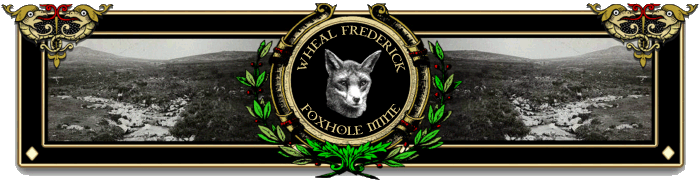
“Some call it this, some call it that…“, some call it Foxholes Mine, some call it Wheal Frederick, some will even say its; “remains offer one of the best sites on the Moor to see the processes associated with tinning operations in one concentrated spot.”, Brown, p.2. According to Mike Brown the location of Foxhole Mine is on the opposite side of the Doe Tor Brook to the visible remains of Wheal Frederick and consists of an area of streamworks and blocked adits, p.2. Even English Heritage in their Pastscape record refer to the; “Foxhole Tin Mine.” as opposed to Wheal Frederick. There is also a suggestion that for a short time during the 1850s the mine was known as ‘The Duke of Wellington Mine’, Greeves, p. 23.
Most of the noted Dartmoor topographical writers give little mention of the mine and in all reality the only three detailed articles on the subject are those written by Brown, Greeves and English Heritage. Despite this lack of information Wheal Frederick is still a fine example of Dartmoor’s industrial archaeology and well deserved of a mention on this website.
Tin extraction in the form of streaming took place on the Doe Tor Brook as far back at the late 1500s as a document of the time indicates but it was not until 1845 that the mining sett known as Wheal Frederick was established. In 1855 another document actually described the limits of the mine as they stood at that time as can be seen from the map below. By 1887 the mine had permanently ceased operations with all of the various items of machinery removed. The site was then left to gracefully retire with nature slowly reclaiming the landscape which we see today. I do not propose to detail all the owners of this mine here but if you want the names and dates then Greeves’ article gives a long rambling list of these. What I am more concerned with is are the visible remains of today and what originally would have been present when the mine was working.
As can be seen from the plan and aerial shot the site basically consists of five main discernable, they are; the dressing floor, the wheelpit with its associated tailrace and stamps area, the captain’s house, the tramway and the leat channel.
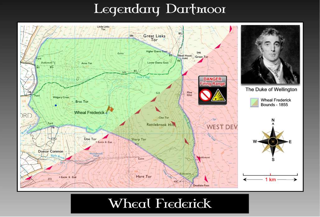
Wheal Frederick Map |
Wheal Frederick Plan |
Wheal Frederick |
Apart from the actual tin ore the most important requisite of a mine is water and this would be taken via the leat from the Doe Tor Brook and taken to the wheelpit. The leat channel measures around four metres wide with a depth of one metre and would have conveyed a large quantity of water to the stamps area. Here it would power the waterwheel which in turn would have worked the stamps used to crush the ore. Today the stamps area consists of a level platform measuring 4.5 metres by 6.9 metres and the adjacent wheelpit weighs in at 7.6 metres by 1.3 metres. From the stamps area the water was then taken via the 25 metre long tailrace to the dressing floor from whence it would flow back into the Doe Tor Brook.
Although Wheal Frederick is outside the boundary of Wilsworthy firing range it did not stop the leat embankment being used as a machinegun emplacement as can be seen from the photograph below. On the day of my visit there were two of these heaps of cartridges, belt clips and bottles of gun oil left strewn along the leat channel. Although the cartridges were blanks many of them were still ‘live’ as evident by the lack of firing pin marks which I would imagine would be a tempting find for any young children. Obviously during an exercise there may not be a chance to clear up such debris but surely somebody should be removing any such things as a priority?
Having followed the water’s route it may be an idea to do similar with the tin ore which once extracted would be taken to the stamps area by means of the tramway. Sometimes known as a ‘knocking or knacking mill’ the ore would be crushed by two or three large wooden posts with iron ends know as ‘stamps’. Powered by the waterwheel the heavy stamps would be lifted then dropped in a continual cycle onto the ore thus pulverising it. Just on the edge of the stamping floor can be found a large granite slab which appears to have been fashioned for use as some support or other. Apart from that there is very little visible from the remains of the stamps area.
From the stamps area the now finely crushed ore would then betaken to the dressing floor where it would be placed into a shallow pit or pits known as ‘buddles’. Here the flow of the water would agitate the ore and wash away the lighter waste material leaving the concentrated heavier ore in the buddles thus giving black tin which was ready for smelting. The buddles at Wheal Frederick are said to be unusual insomuch as they are circular with a squared and holed stone acting as a central bearing which contained a sweeping arm that would skim the deposited tin slime. There is no evidence of a smelting or blowing house at Wheal Frederick which means that the dressed ore would have to have been taken off-site to another unknown location. Presumably, due to the mine’s location this would have involved the use of packhorses of some kind or another?
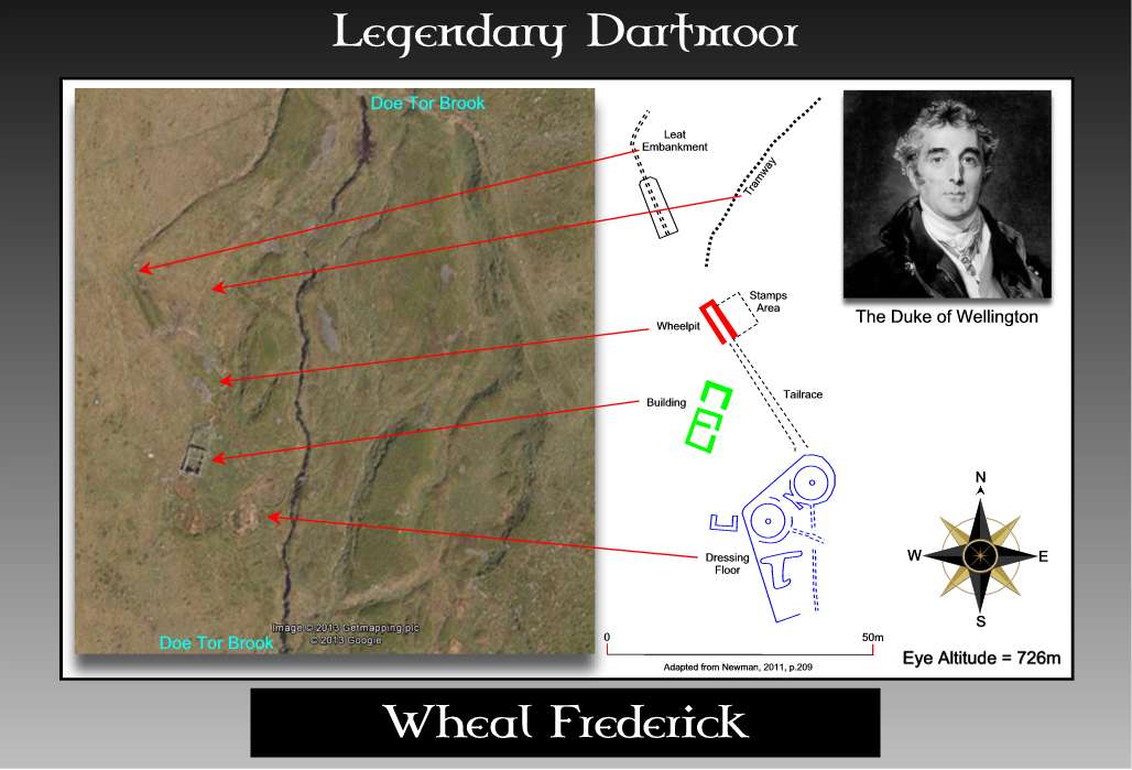
The most obvious feature of the mine today is the shell of the two-roomed dwelling which served as the mine manager’s house although Greeves does suggest that in 1854 it was the mine’s smithy, p.24. The internal size of the main structure is 6 x 3,6 metres with its doorway in the eastern wall. The walls are 0.6 metres thick with visible fireplaces insitu at each end of the dwelling. There are also the remnants of an extension located at the northern end of the structure which measures 4.4 by 3.6 metres.
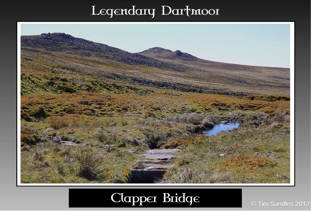
Clapper Bridge |

Trackway |
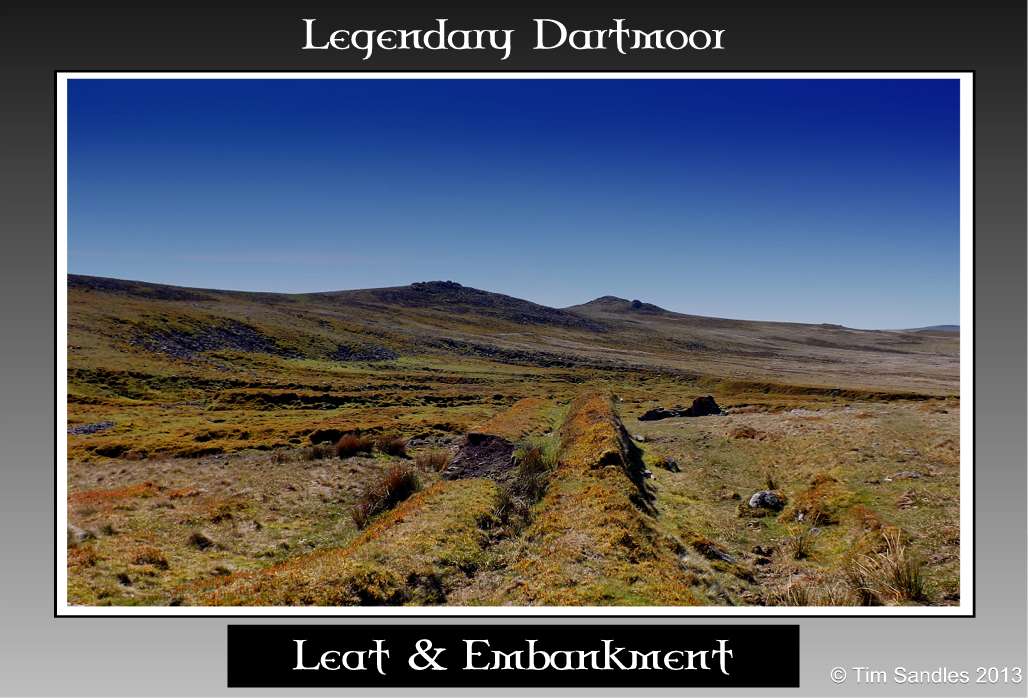
Leat and Embankment |

Leat Embankment |
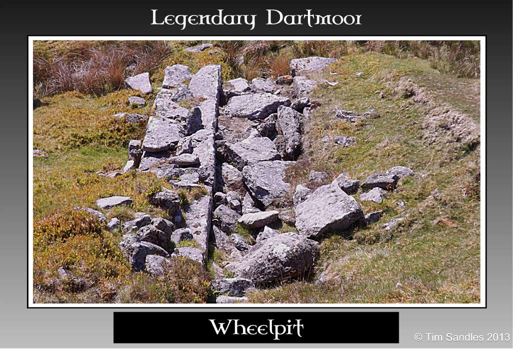
Wheelpit |
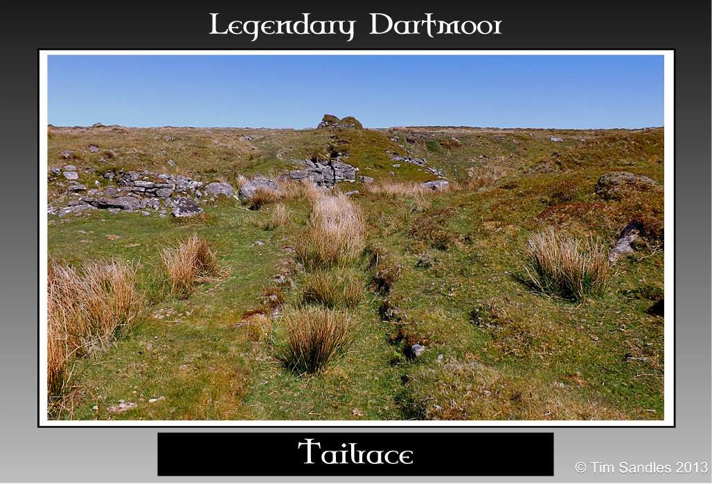
Tailrace |
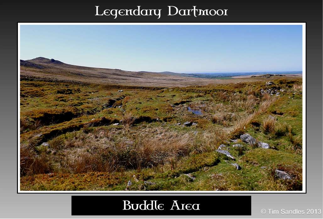
Buddles |

Granite Support |
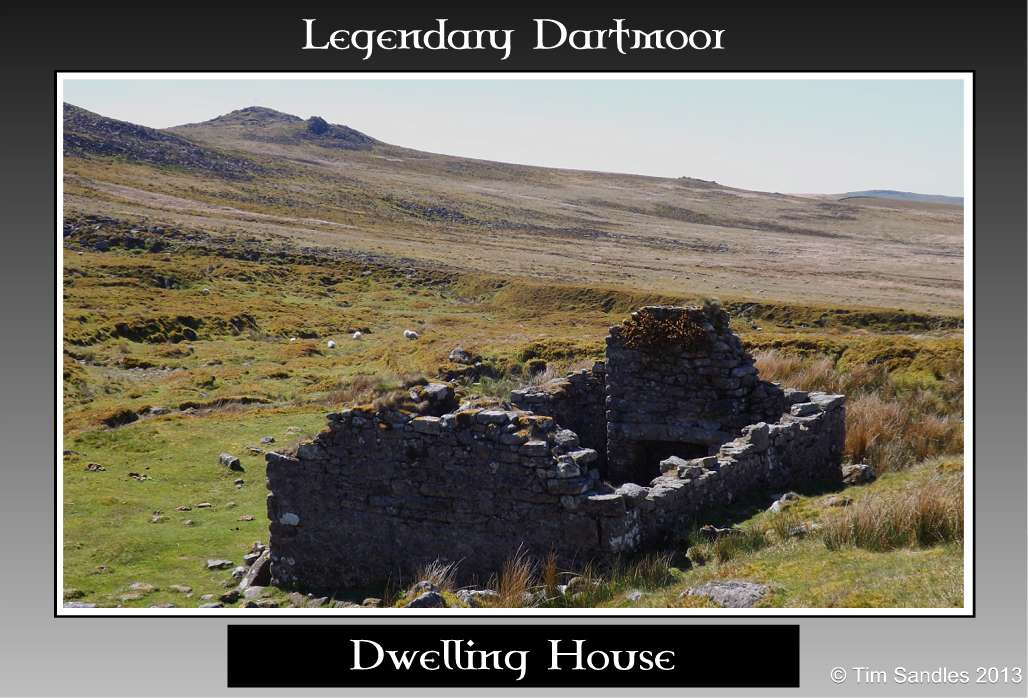
Dwelling House |
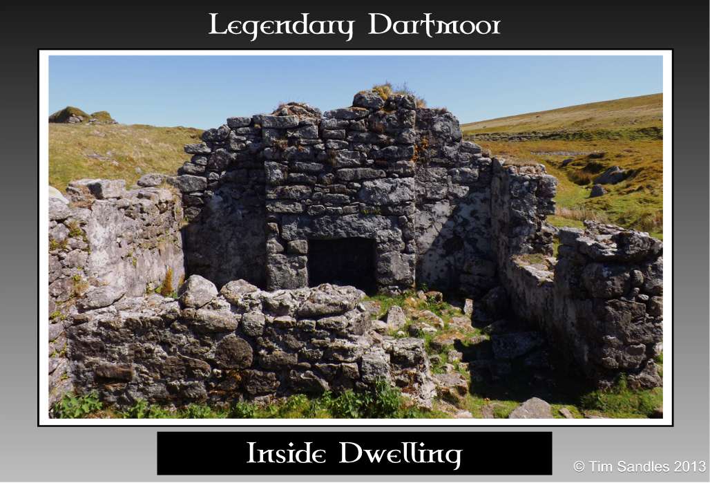
Inside Dwelling |
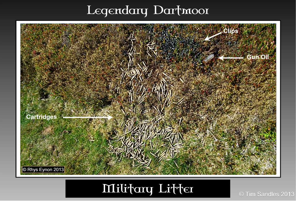
Military Litter |

Military Litter |
Today the soundscape is one of the gurgling brook, skylarks warbling in the heavens and the occasional bleat of a sheep all mingled on the moorland breeze. How different to what it would have been like some 150 years ago, the peel of the heavy stamps pounding the ore, water cascading down the leat, the chatter of young boys as they toiled at the mine along with the rumble of loaded carts trundling down the tramway.

Baring Gould, S. 1896. Dartmoor Idylls. London: Methuen & Co.
Brown, M. 1998. Dartmoor Field Guides – vol. 33. Plymouth: Dartmoor Press.
Greeves, T. 2003. Wheal Frederick Tin Mine – Dartmoor Magazine – No.73. Brixham: Quay Publications.
Newman, P. 2011. The Field Archaeology of Dartmoor. Swindon: English Heritage.