 Legendary Dartmoor The many aspects past and present of Dartmoor

Just under the southern shadow of the mighty Great Links Tor rises a small brook, it actually gurgles out of a spring which sits at an altitude of 504m. From here it tumbles down its short course of about 2.91km to meet the River Lyd which awaits its waters a good 262m below. So, as you can see the Doe Tor Brook is not one of Dartmoor’s most spectacular brooks but it does run through some spectacular moorland as it descends the 242m before being swallowed up into oblivion. In other words the Doe Tor Brook makes a brave but brief statement upon the vast landscape of Dartmoor and one that in my opinion is well worth experiencing.
So, my particular ‘experience’ started on Brat Tor where I had arranged to meet my friends Rhys and Louise who were arriving later that morning. The plan for the day was to complete the moorland course of the Doe Tor Brook in what was going to be a glorious but breezy Dartmoor day. I say complete the brook’s course because we had already walked from Dick’s Well down to Wheal Frederick on a previous visit. This ‘experience’ was a complete contrast as on that occasion Dartmoor treated us to a very wet and very foggy day as can be seen – HERE
As I sat beneath (literally) the shadow of Widgery’s Cross idly awaiting them I happened to look down at the base of the tor where to my amazement I saw a Grey Squirrel. It looked at me, I looked at it and we had a brief impasse, I slowly reached for the camera, the squirrel decided it did not want to be photographed and promptly scampered off around the back of the tor. Despite an expensive search the little fellow was nowhere to be seen so sadly you are just going to have to take my word for this chance encounter. There have been a fair few other reports of squirrel sightings on some of the Northern Dartmoor tors and it does make one wonder what they can find to eat up there?
Having lost sight of my little furry friend I returned to my lookout post where over on Doe Tor I spotted a lone horse rider with two dogs. As the warm, early morning sun beat down I could not help thinking or rather wishing I could swap jobs with the lone rider as it was the Range Warden performing the raising of the flag ceremony. Having said that I am sure his job is not that appealing on days when the moor vents it anger in the form of lashing rain and thick fog. In a weird way the scene reminded me of that famous Iwo Jima statue which stands outside the American Arlington War Cemetery where a group of marines are raising their flag. Having performed his duty the warden quietly rode off along the range boundary clearing the last of the livestock off the range. Unfortunately our paths were going to cross once again that day but more which later.
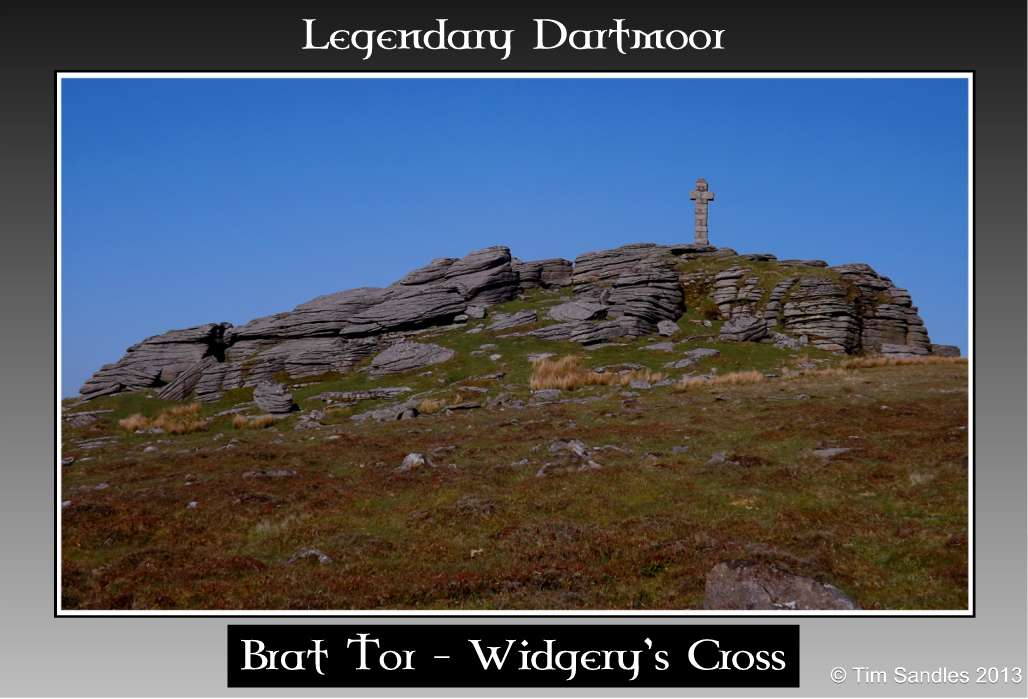
Brat Tor |
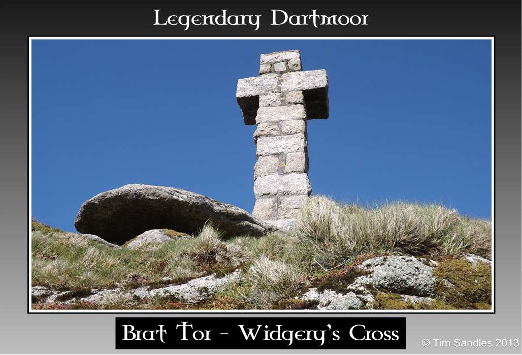
Widgery’s Cross |
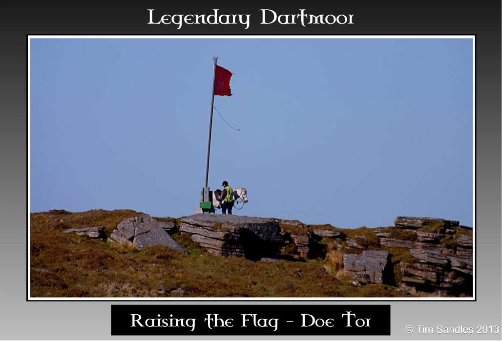
Raising the Flag |
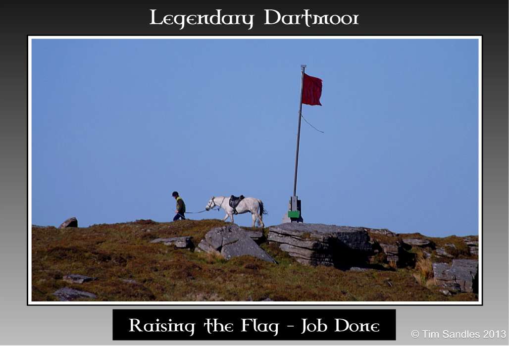
Job Done |
There are many landscape features that have the ‘Doe‘ element in them around the brook and as to how old the name is can only be surmised from the documented dates of some of the landscape features. In 1598 it is documented that one William Chubb, a tinner from Meavy, conveyed a quarter share in a tin working called, ‘Dowbrocke’, (Greeves, 2003, p.22). In the locality the brook has always been known as either the River Doe or the Doe Brook and so it may be postulated that the numerous features take their name from the brook and that the ‘doe‘ element refers to either a deer or a rabbit? However, in his book, ‘Dartmoor Idylls’, Baring Gould (1896, p.122) does come up with another idea, the name of the tor was once ‘Daur Tor‘ which he suggests translates as the ‘Hill of Waters’. This alludes to the fact that the tor stands amidst stretches of bog and is bounded to the north by the Doe Tor Brook and to the south by the Wallabrook. Admittedly his book was a work of fiction but the Welsh word for water is in fact Dwr and to me the ‘Hill of Waters’ is a much more dramatic place-name.
I always like to start at the top and work my way down and so where better place to start than the head of the brook which rises as a spring in a small gully and is known as Dick’s Well. This has been considered as the true source of the brook as opposed to the other stream which rises to the south east of the lower basin, Hemery, 1983, p.918. Here stands a loan boundstone on which the letters ‘L’ and ‘BS’ inscribed this marks the point where the parish boundaries of Lydford and Bridestowe/Sourton meet. Crossing recalls that at one time the actual source sprint of the Doe Tor Brook rose at the foot of Dick’s Well boundstone, 1990, p.180. As to exactly who ‘Dick’ was after which the well was named has long vanished into the realms of oblivion along with his mortal remains. Just to the west of Dick’s Well is an area of tinner’s workings of which Rowe makes two comments; firstly he refers to the location as “Dick Wheel Pits”, which he suggests the word ‘wheel’ is just a corruption of ‘well’. If however the place-name location is an area of tin mining the could not the words ‘well and wheel’ be corruption of ‘wheal’? Secondly, Rowe tells us of how at one time the whole area was famous both far and wide for being somewhere that whortleberries could be picked “by the gallon,” p.68. William Crossing also confirms this fact when he comments that:
“From Mary Tavy and Lydford the gatherers go chiefly to the upper part of the Doe Tor Brook, and to the slope of Hare Tor above the Tavy Cleave. The little valley in which the brook named takes its rise is formed by the ridge extending from Links Tor to Hare Tor on one side, and on the other by that on which Arms Tor and Bra Tor are placed. It is known in the neighbourhood as Foxholes, from a mine of that name which formerly existed there, the remains of which may still be seen… This area is constantly visited by gatherers during the season, but so abundant is the fruit there that day after day they are able to return with a plentiful supply… Foxholes is about six miles from Mary Tavy but the pickers think little of such a distance provided it brings them to a spot where there is no lack of berries”, Crossing, 1966, pp. 85 – 6.
Although early in the whortleberry season one could clearly see exactly what Crossing meant about ‘abundant fruit‘ as virtually the whole of this moorland tract was tinged with hues of russet and red thanks to the blankets of whortleberry plant

The Doe Brook |
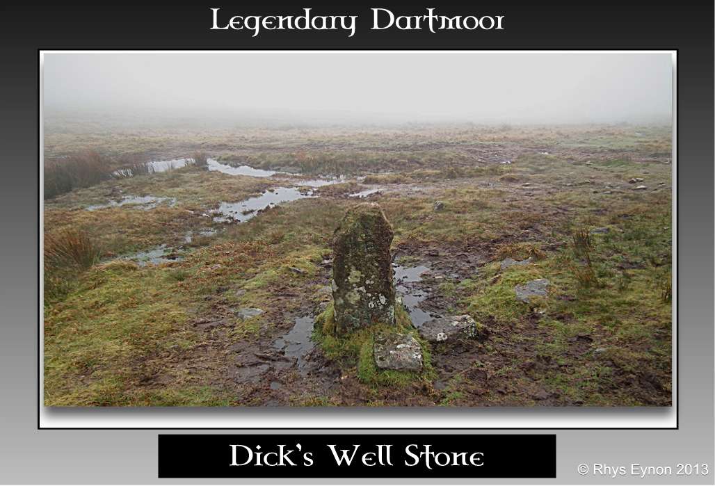
Dick’s Well Stone |
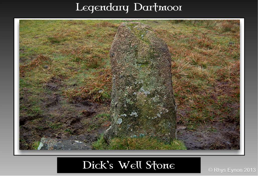
Dick’s Well Stone |
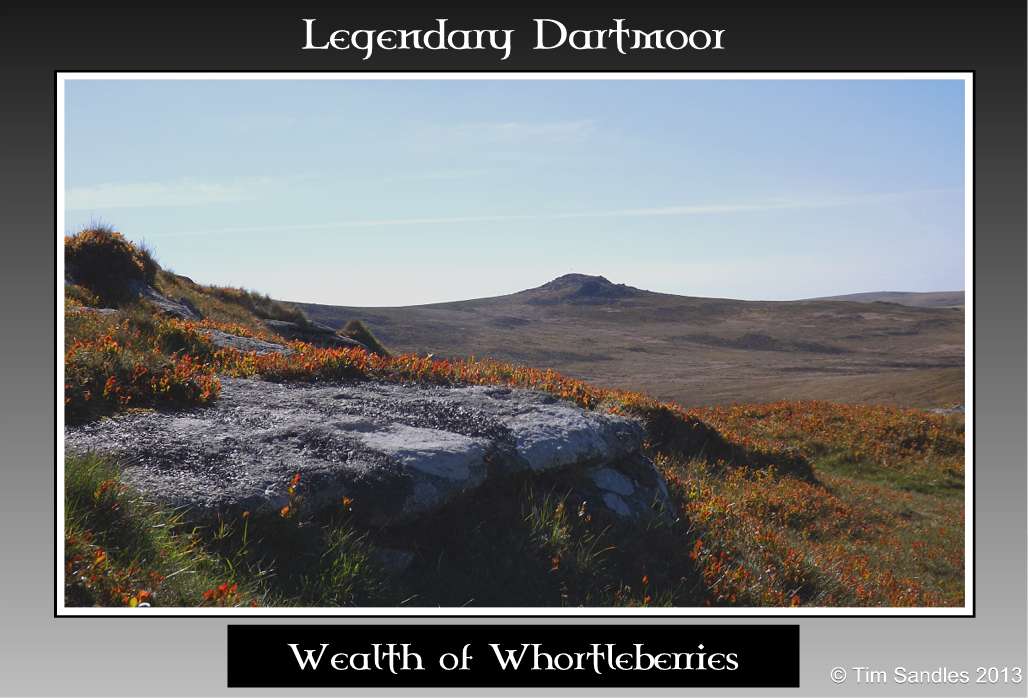
Wealth of Whortleberries |
From its source the Doe Tor Brook wends it way gently down through tin streaming works until reaches a fairly large clapper bridge which heralds its arrival at Wheal Frederick. It was here during the 1800s that the brook generously loaned its waters to power the mine’s waterwheel and washing facilities. Today, although nature has reclaimed much of the landscape many of the mine’s components can still be seen. Also highly visible were two huge scatters of machine gun cartridges and their belt clips which although blanks did contain some ‘live’ ones. The soldiers had clearly used the leat’s embankment as a firing position and then simply left their litter. The subject of the military’s use of Dartmoor has always been a contentious issue and instances like this do not help their cause one bit not to mention a risk to inquisitive walkers – see the War Zone page.
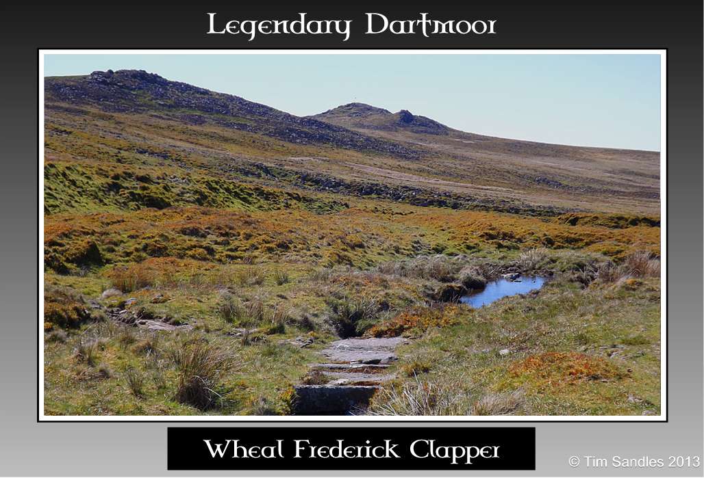
Clapper Bridge |
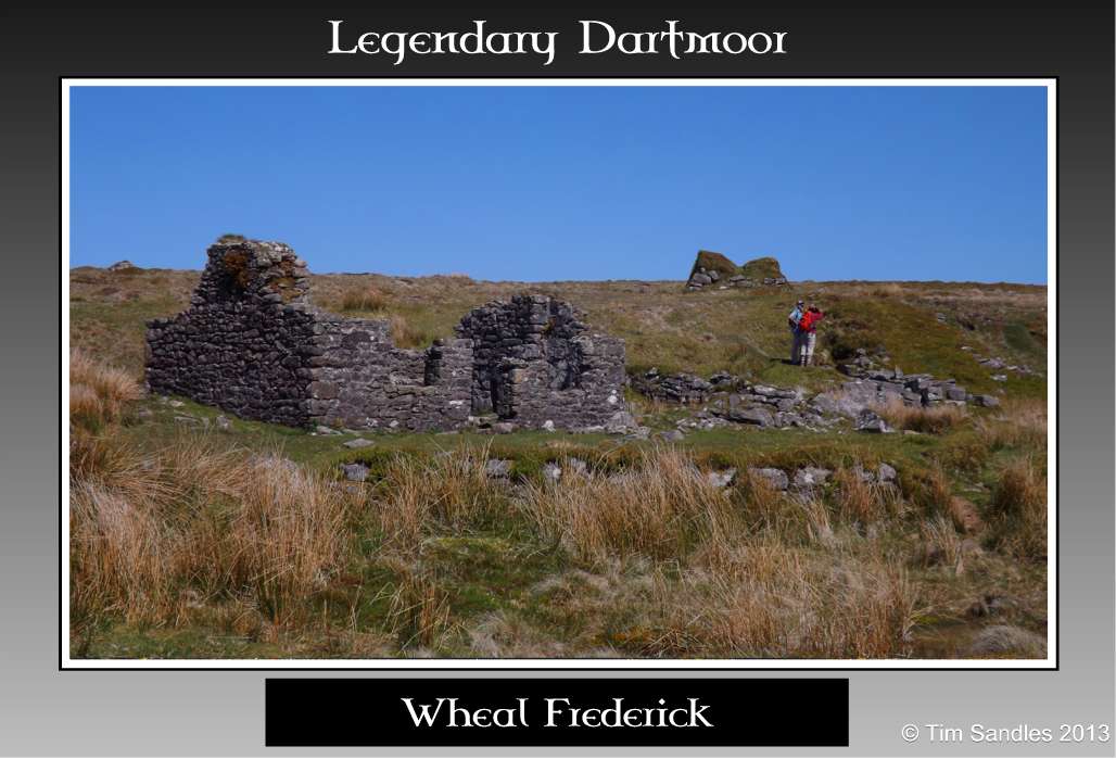
Wheal Frederick |
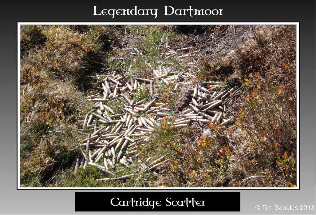
Cartridge Scatter |

Cartridge & Gun Oil |
From Wheal Frederick the Doe Brook takes a lazy, levelish course through more stream works and eventually makes it way under the shadow of Doe Tor. In some of the small crystal clear pools it was easy to spot a few good sized trout nonchantly swimming amongst the weed covered rocks. Doe Tor is actually made up of three separate granite piles and at it’s highest point stretches up to 425 metres which affords an excellent panorama over Willsworthy and then far out into the Cornish distance. Some suggest that these granite formations resemble a reposing Doe Deer and this being the reason for its name but look as hard as I might I could not see such a likeness neither from a distance or close up. On the central pile is a small Rowan sapling which seems to be gravely clinging on for dear life and is somehow managing to flourish despite its exposure to the harsh moorland elements.
On Doe Tor is a rectangular enclosure (OS grid ref. SX5419 8484) which was formed on three sides by utilising the natural granite outcrops and on the fourth side a drystone wall. The wall is lined on both side with upright granite slabs, it runs for 21.8 metres and varies from about 0.2 – 0.6 metres high. It has been suggested that this structure may possibly be the remnants of a prehistoric tor enclosure similar to that on White Tor. There is no apparent sign of any building stances which would be characteristic with such monuments. There is no firm conclusion to their date although possible similar ones in Cornwall have provided evidence for Neolithic occupation some 5 – 6,000 years ago. As to their purpose it is known that there was no intent of settlement and so maybe they served as communal meeting places where feasting, exchange or funereal rites took place, Newman, pp 32 – 33. In a way such places may well be considered as the predecessors to the modern day community or village halls where people gather for committee meetings, dances, fetes, etc. Just that with a tor enclosure it’s a bit more of a trek to get to and less weatherproof. On the north westerly pile is the forlorn shell of a small, single roomed lookout shelter which was once used by the range wardens. It would have been from here that they kept their vigil thus ensuring that no errant walkers strayed into the firing range.
It was whilst on Doe Tor that the range warden once gain appeared, this time to lower the red flag indicating that the firing exercise was over. All in all the entire exercise must have lasted only about two hours maximum which does beg the question was it worth the time and effort involved in clearing the range, flying the flags and then taking them down again? Anyway I did take the opportunity to inform the warden of the ‘military detritus’ at Wheal Frederick and he assured me he would report the matter and; ‘somebody with a bag would go and clear it up’ – I think a sack would be of more use! Hopefully whilst somebody is out with a sack they could also visit the tor and clear up the empty ration packs that are strewn around!
There are some interesting geological features on Doe Tor, especially the jointing of the granite which form some strange shapes with some even having lines of large nodules which give the appearance of a spinal column.
Some two hundred metres to the east of the tor is a Bronze Age round cairn and its associated kist which in 1905 was partially excavated by the Dartmoor Exploration Committee. Not a lot was learnt of the monument except it had been despoiled at some point in time and a single, small fragment of charcoal was discovered. The cairn mound has a diameter of 5.6 metres and stands to a height of 0.5 metres. The kist internally measures 1.3 metres long by 0.8 metres wide and 0.6 metres deep with its possible capstone a short distance away.

Doe Tor (s) |
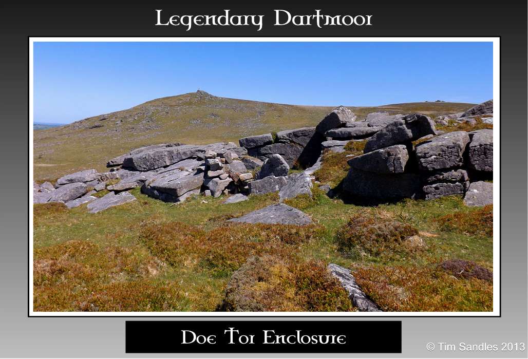
Enclosure |
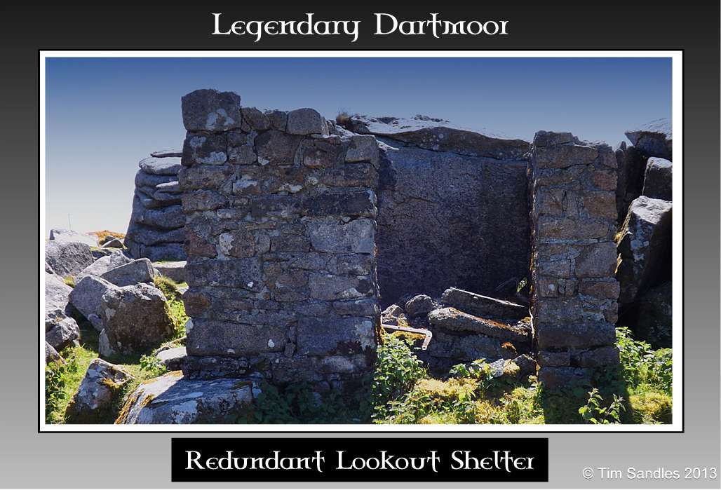
Old Lookout Shelter |

Rock Formation |
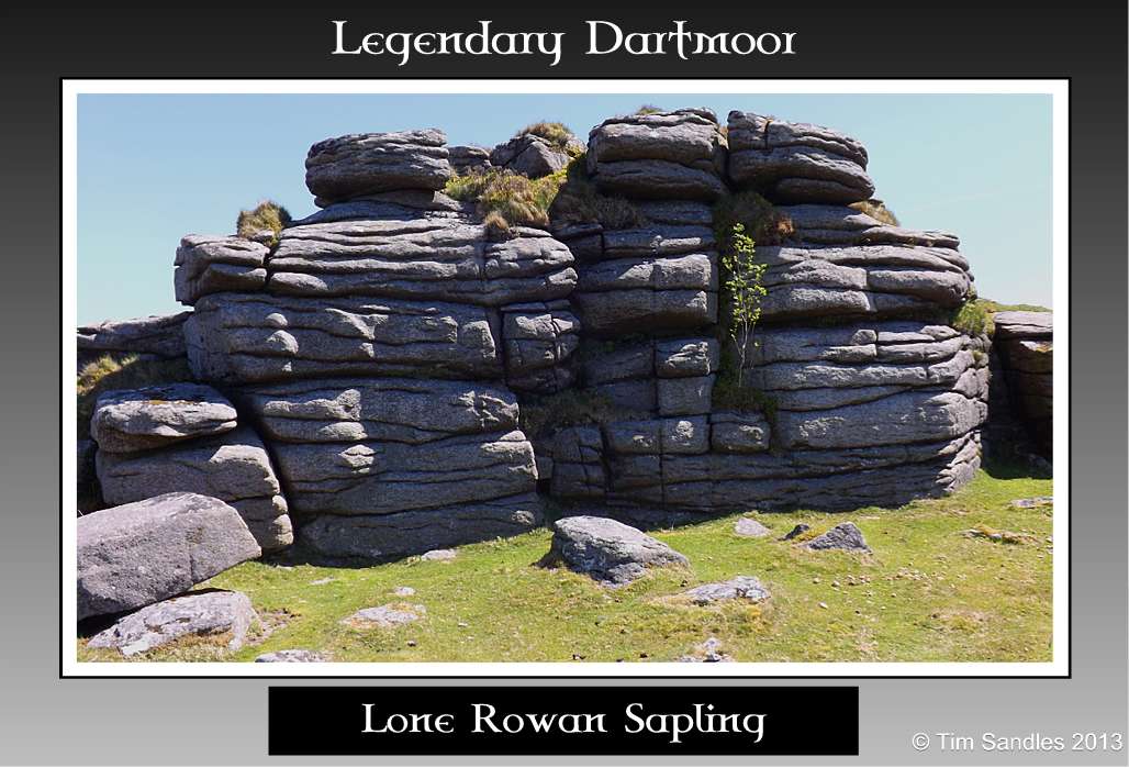
Lone Rowan Sapling |
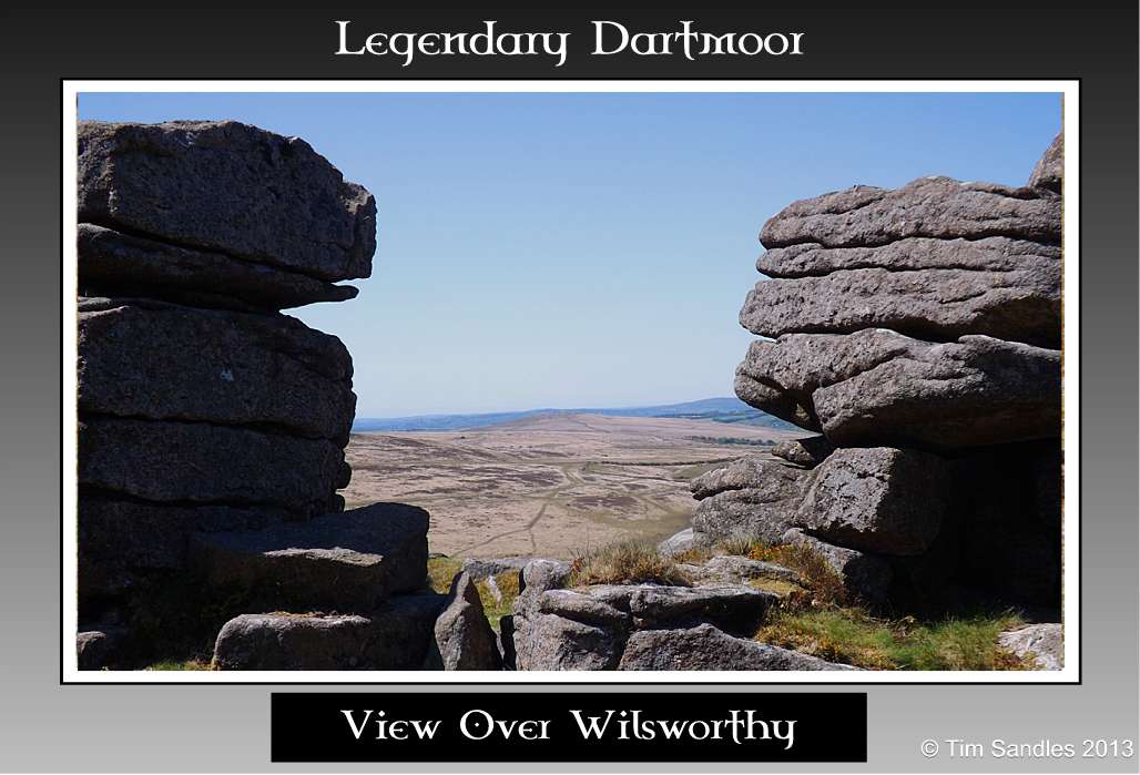
View Over Wilsworthy |
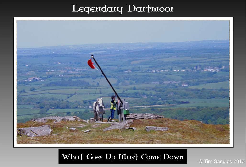
It goes up, it comes down |
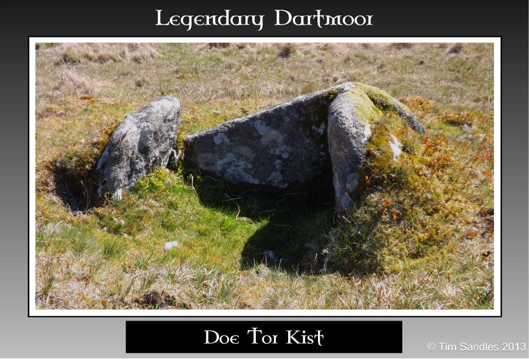
Doe Tor Kist |
Once past Doe Tor the brook begins to liven up as is tumbles over a series of small cascades all flowing alongside egg yoke yellow bushes of Dartmoor Custard (gorse). Having had its waters ‘borrowed’ by Wheal Fredrick it was at the middle reaches of the brook that the poor little brook had some more permanently ‘borrowed’ in order to supply Lydford with water. The scene of the crime or extraction point is marked out by four granite boundstones, all carry the inscription of T R D C which stands for Tavistock Rural District Council. It was front this area that the water was leated off to implement the village’s thirst. Nearby there is another water-related object and a manhole cover, presumably these are related but of this I have no definite idea as to their purpose.

Start of the Descent |

Getting Faster |
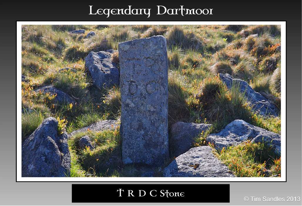
T R D C Stone |
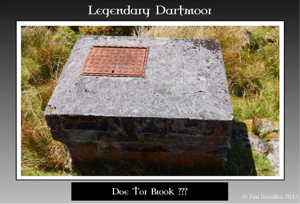
??? |
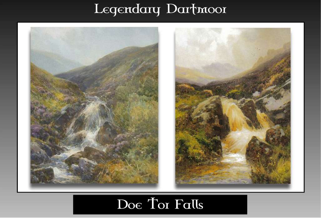
The next section of the brook’s course sees it revving up as the descent gets steeper and the cascades bigger, first by a fairly nice set of falls and then finally reaching THE Doe tor Falls. It was here we decided to stop for lunch and I cannot think of a nicer spot to enjoy the scene, basked in warm sunlight and being serenaded by the tumbling waters. These falls have been the inspiration of several artists throughout the ages as the examples below demonstrate. As luck would have it the flow of the water was not that great over the falls which allowed for the various mosses to be seen in all their splendour. There were greens, yellows. pink and every shade of mauve imaginable – truly as sight to be seen. As we sat at the falls an airliner took off from Exeter airport and made a sharp ascent followed by a sharp bank to the left which left a clear vapour trail in the cloudless blue sky. I could not help thinking that if you were aboard that plane off on some exotic holiday in search of the sun, in fact it was several thousand feet below you and did not involve the hassle of air travel.
Doe Tor Falls |
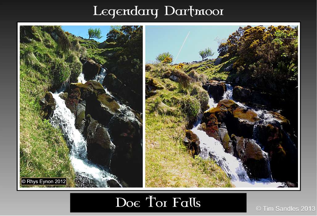
Doe Tor Falls |

Doe Tor Falls |
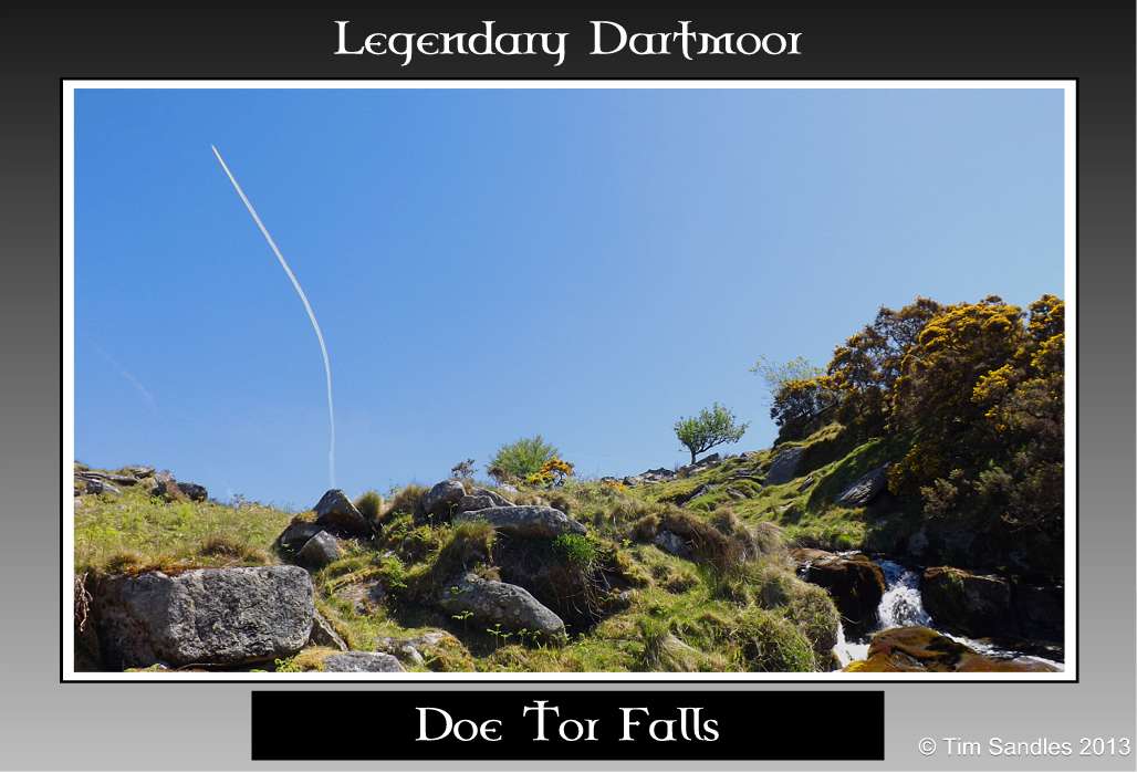
Doe Tor Falls |
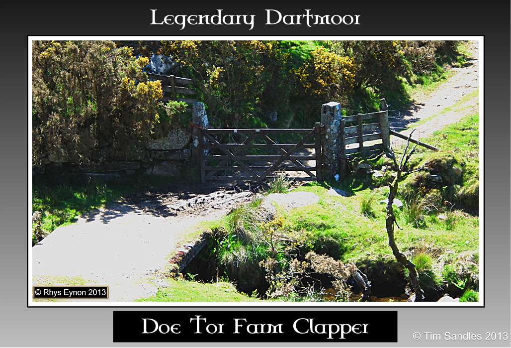
From ‘The Fall’ it was just a short distance down to the clapper bridge which carried the track leading across to Doe Tor Farm. What spans the brook today is a fairly recent concrete construction which is practical if not picturesque but it does serve as an example of the possible power of Dartmoor’s water courses. On this particular day the little Doe Brook was fairly ‘busy’ flowing under the bridge but the reason the clapper is a modern addition is that at some point the brook was in full spate and washed away the original one. The force of the water needed to do this would have been tremendous as the granite slabs which formed the bridge would have had a combined weight of several tons.
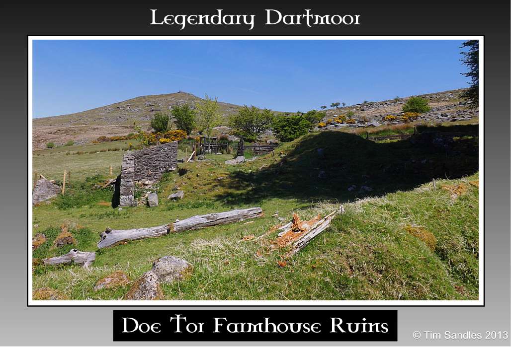
Today Doe Tor Farm simply consists of the field enclosures and the ruins of various farm buildings but only as far back as the 1950s was a working farm. Now the Ministry of Defence own the land and rent it out for grazing land which on this particular day was home to a flock of Welsh Black ewes and their lambs.
Whilst exploring the various ruined buildings it was obvious that somebody had ‘camped’ in the old shippon because not only had they left the remains of a camp fire but also their frying pan and Tupperware container – somebody wouldn’t have been to pleased when they got home. All the time we were at the farm an invisible cuckoo was calling from the various trees around the home field. There is an old saying that when the cuckoos first arrive their call is ‘cuckoo, cuckoo’, but when they are ready to leave for foreign climes it changes to ‘cuckoo, keek, keek’:
In April I open my bill
In May I sing night and day
In June I change my tune
In July far far I fly
In August away I must
From the calls of this particular bird it sounded as if it was ready to leave already. According to the R.S.P.B. the cuckoo numbers in the UK are in serious decline, so much so they are now listed as a ‘Red Species’. They are well noted for being secretive birds and at the most allow just a passing glimpse of their presence. I have only ever seen them in flight at a distance until this particular day. Eventually we spotted the bird in a holly tree about fifty metres away, it then flew into the adjoining field where it was ground feeding on insects. Having caught it’s meal the bird then flew onto a nearby post rail to await its next hapless victim which when located was dived upon from the perch. Maybe this particular cuckoo was more intent on eating as opposed to what we were doing because it allowed us to slowly get within ten metres of it. This really was a ‘wow’ moment as it was the closest I have ever been to a cuckoo and the first chance I have had to take a decent photograph of one – truly amazing.
Doe Tor Farm Clapper |
Farmhouse Ruins |
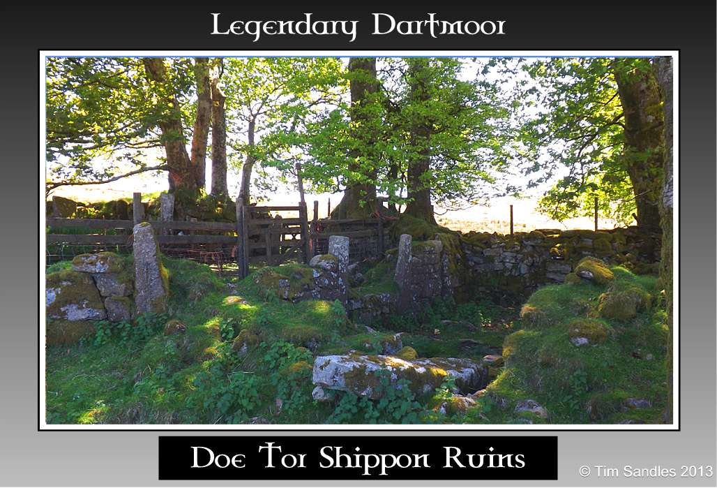
Shippon Ruins |
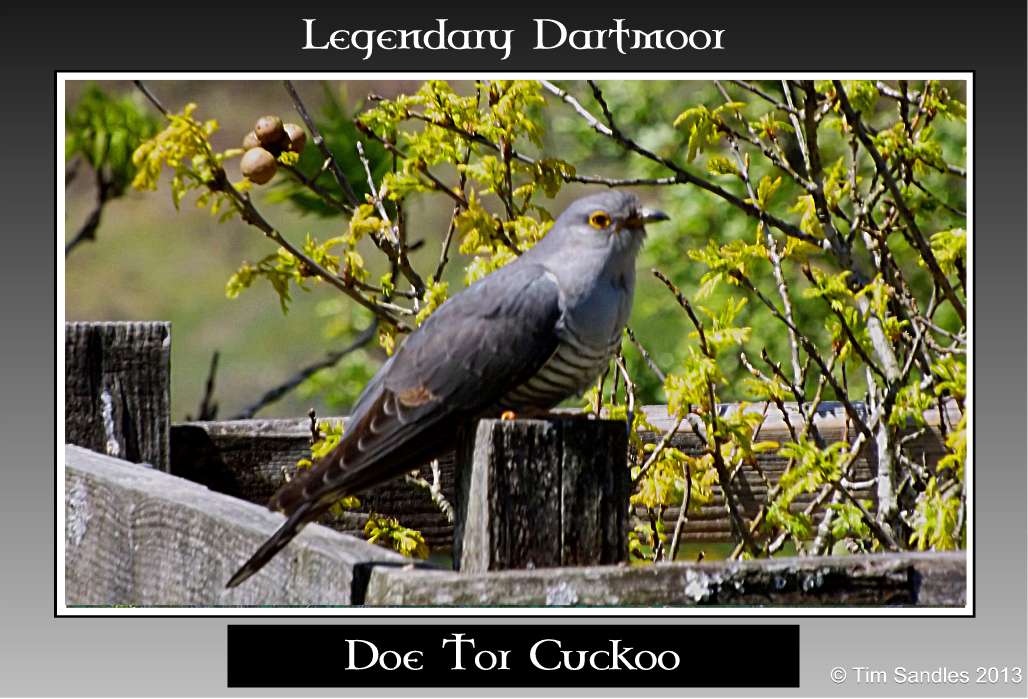
Doe Tor Cuckoo |
Once past the farm the Doe Tor Brook flows down for about five hundred metres before joining up with the River Lyd and thus marking the end of this journey. One last little incident, as we approached the stepping stones at High Down Ford we noticed a pile of clothes and a handbag left on the opposite bank of the Lyd. Our first thoughts were that as it was a hot day maybe we had caught out a woman skinny dipping but it became obvious that there was nobody around. Second and more gruesome thought were that perhaps some poor soul had decided to go and eat with the fishes so we decided to have a proper search down stream. Thankfully there was no body floating in the river and still not a soul in sight but eventually we spotted a couple walking down from above the steps and when they finally neared we asked them if the clothes and handbag were theirs. Yes they were theirs and were left unattended because; “they didn’t think anybody was around,” – yeah right.
But what a day, it had everything Dartmoor has to offer, good company, glorious weather, exhilarating air, stunning scenery, diverse wildlife, history, archaeology, geology, heritage, exercise and all for free – who could ask for more?
Please note: technically speaking the kist near Doe Tor is just within the Willsworthy firing range albeit by a matter of feet.

Baring Gould, S. 1896. Dartmoor Idylls. London: Methuen & Co.
Crossing, W. 1966. Crossing’s Dartmoor Worker. Newton Abbot: David & Charles.
Crossing, W. 1990. Crossing’s Guide to Dartmoor. Newton Abbot: Peninsula Press.
Greeves, T. A. 2003. Wheal Fredrick Tin Mine – Doe Tor Brook, Dartmoor Magazine No.73, Brixham: Quay Publications.
Hemery, E. 1983. High Dartmoor. London: Hale Publishing.
Newman, P. 2011. The Field Archaeology of Dartmoor. Swindon: English Heritage.
Worth, R. H. 1988. Worth’s Dartmoor. Newton Abbot: David & Charles.
Thanks for this lovely account. August 2022 a long section of the brook just north of the Tor has dried out, then the section running down to the falls is sluggish and has thick green algae. I don’t think that it is the driest I have seen the Moor but it isn’t far off.