Well, how does one start to try and describe Dartmeet? You either love it or do everything in your power to avoid it, especially in summer. The main attraction is exactly what the place-name suggests, the place where the West and East Dart rivers meet – namely a confluence. They then flow on down the valley for a couple of miles when the river becomes the ‘Double Dart’ which flows down to Buckfast to become the ‘River Dart’. And apart from an ancient clapper bridge, it is basically your lot. So why is Dartmeet described as a ‘beauty spot’, ‘honey spot’, ‘tourist attraction’ or less polite a ‘grockle gathering’? Since the advent of the combustion engine Dartmeet has been a popular destination for the .moor seekers’, obviously it was easy to get to either on a charabanc tour or in later times by private car. Illustration number 13 on the left, clearly shows the popularity of the place in the early 1950’s and it hasn’t got any better today. The other illustrations are all early postcards from Dartmeet and these are but a few of the many that have been published over the years. It is interesting to see how most of the early cards from the late 1800’s simply depict the old clapper bridge. As time goes by the postcards have ‘zoomed’ out and portray the surrounding landscape in a more ‘picturesque’ manner.
The first mention of the place is in a Duchy of Cornwall document dated 1616 where it was called – Dartameet, Glover et al (1992, p.198). Although not precisely named the East and West Dart rivers form part of the old Forest boundary which means Dartmeet lies on it too. The 1240 perambulation states: “… and so by the Dert to the other Dert, and so by the other Dert going up… ,” no mention of Dertmeet?
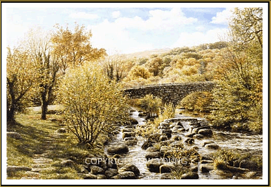
Perhaps it would be an idea to have a look at the more notable features of Dartmeet, namely the bridges, and Badger’s Holt. Starting with the bridges, there are two bridges which span the East Dart river, one is an ancient clapper bridge and the other a more modern addition. The old clapper bridge formerly had five granite spans which according to Crossing (1986, p.115) was washed in away in 1826 when the East Dart River was in full flow. Rowe (1985, p.161) notes that it was then re-erected in 1888 by the Dartmoor Preservation Association. Clearly the anger of the river has been vented once again on the clapper as the fallen imposts testify. The modern bridge which stands alongside the ancient clapper has two semi-circular arches that each span about 30ft, a tablet in the centre records the fact that it’s a county bridge and bears the date 1792, Henderson (1938, p.32).

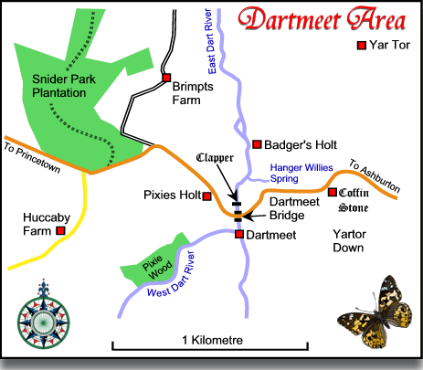
You will see from the above map that there is Pixies Wood and there are no surprises for guessing what’s coming next. Just below the bridges is Huccaby Cleave and in 1890, Crossing (pp. 5 – 6) reveals that in the Cleave are four large sycamores and under these is a small tunnel-like cave where the piskies live/lived. He notes how on moonlight nights if one was to approach with stealth it would not be improbable to see the piskies gambolling around a fairy ring. Do not get confused with the Pixies Holt which is shown on the map, this is indeed a building and is now an outdoors educational centre. Mind you I expect with some of their younger visitors it still might be deemed as a home for naughty little piskies and that’s putting it very, very politely.
Now the question is, which came first, the tourists or the piskie stories? Not wishing to be sceptical I would say it was a close run thing, afterall what better way to attract tourists than to come up with magical stories of piskies. I am sure at some point of time some enterprising moorman has though about doing guided ‘piskie safaris’ for the holiday makers. Walk up the hill from the bridge for a few hundred yards and you will be faced with a little wooden cabin called – Pixieland which is said to be, “the home of the Dartmoor pixie and Dartmoor’s most famous gift shop.” Here you will be able to see hundreds of the little folk along with the usual souvenirs of your visit.
Upstream from the bridge is a tea room called Badger’s Holt. At one time there were two cottages here in which George Caunter lived in one and Joe Leaman and his brother Daniel in the other. Eventually these were replaced with a fishing lodge which in turn has become the tea rooms and holiday apartments. The Badger’s Holt tearoom boasts the fact that it is the, “most famous tea-rooms on the moor,” they also serve Devon Cream Teas to a secret fifty year old recipe.
In 1919 the government under the Dartmoor and District Hydro-Power Supply Bill proposed to built a power station at Dartmeet but luckily for all concerned this idea was abandoned. Barber (1997, p.10) notes how at one time Dartmeet was the location of a summer camp for a large group of gypsies, They would spend wintertime in and around the moorland towns and then move up onto the moor for the tourist season. Manning-Saunders (1951, p.33) quotes and extract from 1856 which describes such a camp:
“The dark wood on one side, and the barren hill, rising steep and granite-peaked on the other; the rocky stream winding between them, giving back from its deep wells a glimmering from the clear pale sky above; and on the open space beside it, the “dark men of Ind” themselves; the smoke of their fires slowly raising against the twisted branches of the oak trees, and their red cloaks and brightly coloured handkerchiefs strongly lighting up the foreground.”
Well those days are long gone and Dartmeet is now the domain of the tourist with their brightly coloured holiday clothes – yeah right. Today Dartmeet sits at the northern gateway to the Dart Valley Nature Reserve and is an ideal spot to explore from. This is the largest of Devon’s nature reserves and amongst its rarer inhabitants is the blue ground beetle and the otter. The area is also popular with canoeists who paddle down to Newbridge, geocachers and cyclists. And here I will make a confession, I have only been to Dartmeet once, for about 30 seconds, the crowds were enough to last a life time, mind you I have driven past hundreds of times.
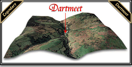
If you want to enjoy Dartmeet pick a cold winter’s day when the tide of visitors will be stemmed slightly. If you really want some excitement try going there very early on an icy day from the Ashburton direction and just hope the ponies and cattle aren’t licking up the salt in the middle of the road. No better not, somebody will have an accident and then say it was suggested here, take a look at the 3D map and you can see how steep and windy the road is. I remember coming back from the Plume of Feathers one dark, misty night and I will admit I was possibly going a bit fast. Halfway up Dartmeet hill a herd of black ponies suddenly emerged from the mist and galloped across the road which was one of those heart-stopping moments everybody loves. I also remember walking up Dartmeet Hill on a baking, airless summer’s day and that was no picnic either, somebody should install a stair-lift.

Mind you going down Dartmeet Hill must have been 10 times worse for the hauliers and waggoners in the days of horse-power. There are reports of timber loads weighing several tons being taken from Buckland Estate to the Brimpts Mine which would have meant descending the hill. Maybe that’s why the Coffin Stone is located by the side of the road?

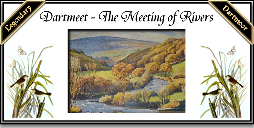
Dartmeet – by kind permission of David Young
For more superb Dartmoor works of David visit his website – HERE
Bibliography.
Barber, C. 1997 The Great Little Dartmoor Book, Obelisk Publishing, Exeter.
Crossing, W. 1986 Gems in a Granite Setting, Devon Books, Exeter.
Crossing, W. 1890 Tales of the Dartmoor Pixies, W. H. Hood, London.
Gover, J. E. B., Mawer, A. & Stenton, F.M. 1992 The Place-Names of Devon. The English Place-Name Society, Nottingham.
Henderson, C. H. & Jervoise, E. 1938 Old Devon Bridges, Wheat & Co., Exeter.
Manning-Saunders, R. 1951 The River Dart, Westaway Books, London
Rowe, S. 1985 A Perambulation of Dartmoor, Devon Books, Exeter.
 Legendary Dartmoor The many aspects past and present of Dartmoor

One comment
Pingback: Dartmeet | Provocation of Inspiration