 Legendary Dartmoor The many aspects past and present of Dartmoor

If tors have feelings then Yes Tor must be pretty despondent, for centuries this majestic granite outcrop had been hailed as the highest place in Devon only, thanks to improved surveying techniques, to be relegated into second place by its close neighbour High Willhays. What made matters worse was that Yes Tor lost its crown for the sake of a miserly 6′.6 7/10” feet (2 metres) which in terms of Dartmoor’s tors is an extra outcrop.
‘Yes Tor, the highest peak in Devonshire, rises, about five miles from the town (of Okehampton) to a height of upwards of two thousand feet. The view from the summit is extensive; the hills of Exmoor away to the north, Rough Tor and Brown Willy in the west, while near at hand the rival hill of Cawsand Beacon and the minor tors and bogs of “the moor” stretch away for miles; but the ascent is difficult and toilsome, over huge masses of granite which lie scattered in every direction; indeed in some places not a blade of grass is to be seen; it is literally a hill of rocks’, (Chanter, 1856, p.43).
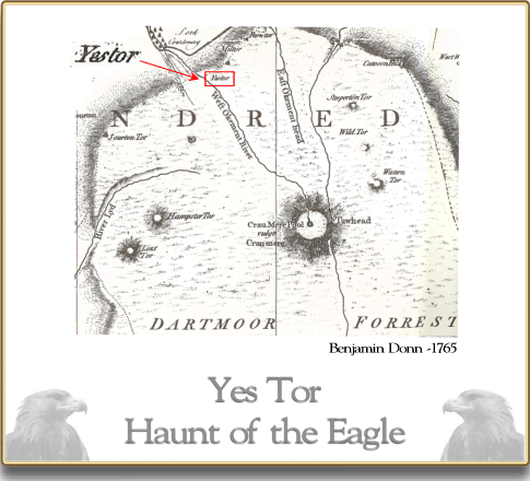
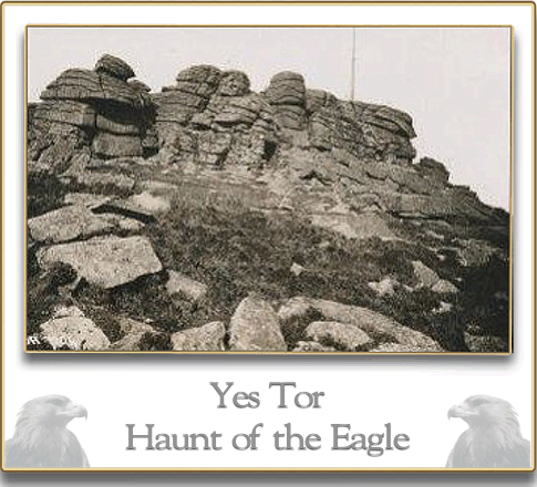
However, Yes Tor can still boast of being part of Dartmoor’s history that stretches way back to prehistoric times, it is home to what must be the highest Bronze Age cairns on Dartmoor if not Devon and as being a recognised point on the boundary of the Forest of Dartmoor. Clearly in 1240 the perambulators considered that it would make an ideal boundary marker and cocked a snoop at nearby High Willhays. In the associated documents Yes Tor was recorded as Ernestorre or Yernestorr which according to Gover et al. (1992, p.205), derives from the Anglo Saxon word earn, (Clark Hall, 2004, p.96) which means ‘eagle’ thus giving ‘Eagle Tor’. Therefore it can be inferred that at one time Yes Tor was the home or haunt to eagles of some kind or other, possibly even Golden Eagles? One of the earliest cartographical records of Yes Tor appears on Benjamin Donn’s map of Devonshire which was published in 1765 and here it was noted as ‘Yestor’ (Donn, 1963, sheet 6b). Some writers contend that the name Yes Tor has derived by means of local dialect from ‘east’ which may well apply to the later Yes element but certainly not the earlier erne element. Page, (1895, p.67) has yet another theory which again completely seems to ignore the early name of Ernestorre:
‘Yes Tor … has baffled both learned etymologist and ignorant peasant; East Tor is the probable interpretation (Anglo-Saxon est), but as it happens to be the westernmost of the tree heights this can scarcely carry absolute conviction. Surely the Anglo-Saxon eyst, a storm, is a root far more plausible.’
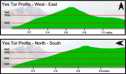
William Crossing (1990, p.201) offers another explanation of the name insomuch as he considered that in a document recording the ancient bounds of Okehampton the tor was listed as Eastor which seemingly equates to ‘Highest Tor’. Another rather grand name which the or has been referred to is ‘Monarch of the Moor’. Albeit eagle, east, storm, or highest either way Yes Tor is still an impressive height of Dartmoor, the western and northern approaches to its summit seem to soar into the sky and rise over 200m over about half a mile as can be seen from the two profiles below:
The high visibility of Yes Tor in the surrounding landscape must have caught the eye of some Bronze Age dignitary who then decided he would be buried on the summit as a mark of his high status. The evidence of this decision can be seen today in the remnants of two cairns located on the north western flank of the summit. English Heritage delicately describe these as being ‘disturbed‘ which basically means that at some point they have been plundered by treasure hunters or that the stones have been recycled for other purposes. Butler (1991, 214) notes that the cairn north west of the summit measures 29m across and displays a trench on its northern side which goes down to the natural bedrock, this being evidence of previous intrusion. The second cairn which is located nearer the summit is now completely damaged thus giving the appearance of a heap of stones. Some time in the late 1800s a scatter of flint flakes was found near the summit of the tor which may suggest that a some point a prehistoric flint knapper sat there fashioning various implements. A field investigation in 2004 revealed a double stone row located about half a mile to the north east of the tor which today consists of 28 standing and 7 recumbent stones. The investigator/s note that originally the two stone rows may have consisted of about 64 stones and could date from anything between the prehistoric period to the modern military times.
It is however the military that have been the most proliferate in imposing their various features and structures upon the moorland as can be seen from the map below. The first military exercises in the Okehampton area were held in 1876 which at the time made use of local moorland tracks. By 1901 these tracks had been improved, widened and in some cases new ones established, this was in order to enable the horse-drawn guns to easily be moved across the moorland terrain. The track shown running from Yes Tor to High Willhays was in fact a branch of the Dinger Track that was used by the peat cutters when going to and from the turf ties to the south. The military road which runs down from West Mill Tor and then skirts the lower eastern slopes of Yes Tor is often referred to as the Yes Tor Road. The various tracks and roads now give easy access to the tor and have negated what at one time would have been a arduous trek. Due to the extensive views and high visibility the tor became an obvious choice for the location of a flag pole from which the red warning flag can be flow during periods of military activity. As part of the Okehampton Range bylaws it was/is a requirement that the signal pole on Yes Tor had/has to display a red light during nightime exercises which on the Okehampton Range is only one of five required to do so. The later addition of a rather hideous army hut on the east side of the tor also takes advantage of the wide ranging views of the moor. This enabled the range wardens to observe the surrounding area should any ramblers inadvertently stray into the range when live firing was taking place. At one time there was a telephone tapping point located to the south of Yes Tor, its purpose was to link into the military network which enable safety communications during training to take place.
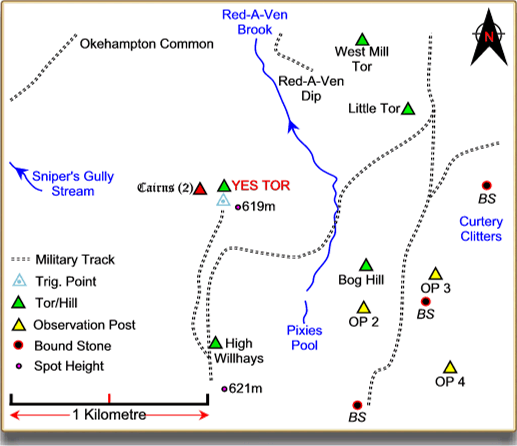
To the south west of Yes Tor are the locations of three military OPs or observation posts, namely numbers 2, 3 and 4 out of which only number 4 remains.
Also on the summit of Yes Tor is a redundant Ordnance Survey trig point which for those interested in such things is numbered S1765. Some may ask, if High Willhays is the highest point why was the trig not sited there? Presumably because of its more northerly location, Yes Tor afforded a more extensive view point in the surrounding landscape?
Amongst the tor’s other claims to fame are that the Scatter Rock brewery have named one of their bottled beers Yes Tor, in 1978 the famous rock band YES released an album called Tormato and on the sleeve was a picture of Yes Tor. Apparently the intended name of the album was going to be Yes Tor but was later changed to Tormato when a tomato was thrown at the original artwork as it was deemed to be boring. There was a class 60 diesel locomotive called Yes Tor and similarly a bulk milk tanker belonging to what used to be Milk Marque.
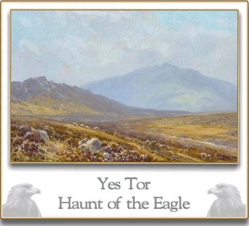
Artists have also found drawn great inspiration from Yes Tor and many have produced dramatic landscapes with the tor looming on the horizon. It was a popular subject of Frederick Widgery who to my limited artistic knowledge produced at least 12 works that portrayed the tor in some form or another. A selection of these artists work can be seen below in the picture gallery.

Donn’s Map of 1765 |
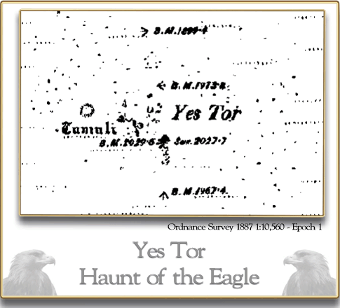
OS Map of 1887 |

Aerial View of Yes Tor |

Yes Tor – F. W. Widgery |

Yes Tor – J. White |
Yes Tor – Unknown |
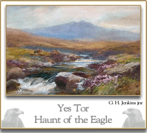
Yes Tor – G. H. Jenkins |
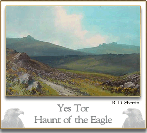
Yes Tor – R. D. Sherrin |
Yes Tor Postcard |
References.
Butler, J. 1991. Dartmoor Atlas of Antiquities – Vol II. Exeter: Devon Books.
Chanter, C. 1856. Ferny combes. London: Lovell Reeve Publishing.
Clark Hall, J. R. 2004. A Concise Anglo-Saxon Dictionary. London: University of Toronto Press.
Crossing, W. 1990. Crossing’s Guide to Dartmoor. Newton Abbot: Peninsula Press.
Donn, B. 1963. A Map of the County of Devon. Exeter: Devon and Cornwall Record Society.
Gover, J. E. B., Mawer, A. & Stenton, F. M. 1992. The Place Names of Devon. Nottingham: English Place-name Society.