 Legendary Dartmoor The many aspects past and present of Dartmoor

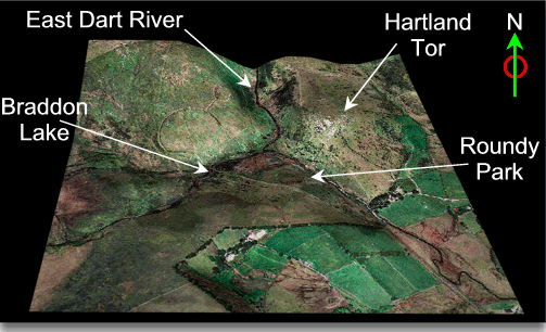
As is evident from many of these pages there are hundreds of prehistoric remains on the moor. Some of them you can puzzle as to why the early settlers of the moor placed them where they did. Roundy Park and its associated settlements are the other side of the coin insomuch as it is obvious why they did. There would have been some natural shelter, a nearby source of water, and some ‘spiritual’ views of the dramatic landscape. The 3D map below shows the topographical location of Roundy Park:
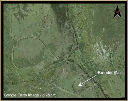
Pick a bright and breezy day and sit by the ancient tomb and just harken to the East Dart river rushing down the nearby valley accompanied by the stonechats chirping amongst the scattered boulders. Then close your eyes and listen to the echoes of village life as those Bronze Age people went bustling about their daily chores. The map below shows the size of Roundy Park and also indicates that it is just one element in a much larger settlement pattern. I don’t propose to drone on about the whole complex but to focus on Roundy Park as it really is a special place.
The walls which can be seen today are a later expansion on the line of the original pound wall but it is soon apparent why the enclosure is called ‘Roundy Park’. All vestiges of the original huts have been virtually cleared away although vague traces can be found near the south western end.
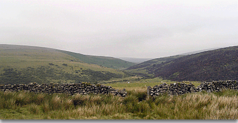
The view up the East Dart valley and the Roundy Park walls
The main surviving relic associated with the ancient settlement is the kistvaen which is located just outside the eastern side of the wall. This tomb is reputed to be one of the largest kistvaens to be found on the moor. It was first recorded in 1893 by Robert Burnard and had already been rifled and the contents dumped alongside. Investigation of the remaining debris inside the kist revealed two small flint fragments and some burnt bones. It was suggested that one of the flints was a ‘scraper’ and the other a ‘crude arrowhead’. Burnard also noted that there was a ‘cooking stone’ propping up one of the end slabs. This probably came from the adjacent settlement and was used to heat food or liquids. Whilst examining the kistvaen, Burnard, carried out some restoration work by re-erecting two of the side slabs which had fallen and restoring one of the large capstones. Burnard recorded that from the bottom, the kistvaen is six and a half feet long and three feet, nine inches wide and is aligned northeast to southwest, a stone circle encompasses the tomb. What sets this kistvaen apart from most of the other Dartmoor examples is that it has seven lining slabs as opposed to the normal four.
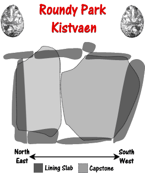
Bernard’s Plan of the Kistvaen
The burial tradition of Roundy Park has continued over about 4,000 years as in 1973 a local Postbridge farmer had his cremated ashes scattered here. If there is such a thing as afterlife, imagine having this for for eternity
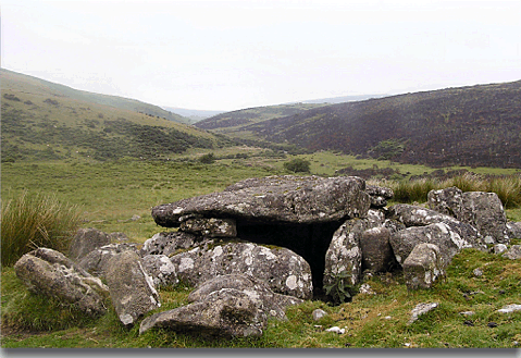
Roundy Park Kistaven
Great article as always. One minor correction for those going to look for the large kistvaen – it is on the W side of Round Park enclosure, not the E side.