 Legendary Dartmoor The many aspects past and present of Dartmoor

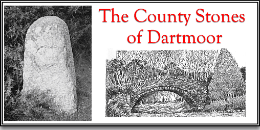
The County or ‘C’ Stones of Dartmoor are often overlooked as a feature of Dartmoor roads. They are always found near the major bridges of the moor and originally would have consisted of a pair of stone pillars incised with the letter ‘C’ which denoted the word ‘County’. Today many of them are either missing, have become lost in thick undergrowth, or are unrecognisable due to thick coats of mosses and lichens.
After the dissolution of the monasteries, Henry VIII realised that subsequently he had lost a major source of funding and administration for the road systems. In order to make up for this shortfall he introduced a ‘Statute of Bridges’ in 1531 which laid down a basis of bridge administration. It was so effective that the statute remained in place until the County Councils were established in 1880. The aim of the act was to make sure that bridges should not fall into disrepair purely because nobody was accountable for their maintenance thus causing them to, “lie long without amendment to the great annoyance of the King’s subjects.” The actual machinery of the statute stated that the bridges were maintained by the various counties, i.e. Devonshire, which came under jurisdiction of the magistrates of the Quarter Sessions. It was stated that: unless it could be proven that: “a Hundred, Riding, Wapentake, City, Borough, Town or Parish or what person certain, or Body Politic” should by right maintain a bridge then a shire or county was obliged to do so. In order that the act was funded and complied with each county levied a rate on all the inhabitants of the administrative area. Each county would appoint two collectors to gather the rates and two surveyors to oversee that any bridge repairs were carried out. It is said that this levy was the foundation of the present rating system. In Devonshire things are always looked upon differently and so initially there were just two collectors appointed as it was decided they could do without the surveyors, well until 1703, anyway. The act required that for every bridge the road over it and for 300ft on either approach should be similarly maintained. In 1841 the Devon magistrates decided that the limits of their responsibility were to be marked by boundstones. These usually were about 3 feet high with an incised ‘C’ on one of the faces and placed one on either side of the bridge, it is said that at the time each stone cost 7/6d each to erect. In some documents and reports referring to men their occupations were listed as being A ‘County Stone Man’ who was responsible for the upkeep of the stones. Below is a list of the Dartmoor bridges where one or more of the stones are still in-situ: The only exception to the norm is the ‘C’ stone at Norsworthy Bridge where a large natural boulder has been used instead of the cut stones.
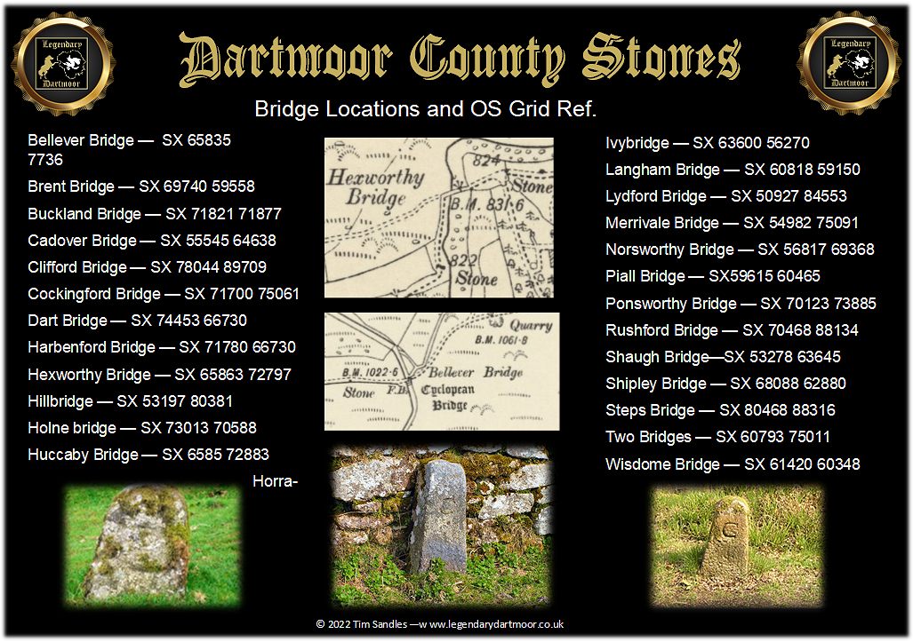
As can be seen from the two map extracts above on the Ordnance Survey six inch map of 1888 – 1913 some of the County Stones are marked. In many cases the ‘C’ stones have been moved from their original locations and incorporated into the stonework of the bridge such as that at Ivybridge. In early road surveyors reports one can often see where urgent bridge and road repairs were needed they were only carried out between the ‘C’ Stones. For example, in 1881 the District Highway Board noted that; “The Clerk be instructed to write to the County Surveyor for the Southern District that the piece of road from the County Bridge to the County Stone on the Buckland side in the parish of Ashburton requires coating with stone.” Again in 1887; “With reference to the Hexworthy road , it is recommended that the road on the right hand side, from the County Stone towards the bridge, should be made twenty foot wide, the present width being only nine feet where the road was most dangerous, and the uneven spaces be filled with rubble.”
So next time you cross an old moorland bridge have a quick look to see if you can spot a lone, moss covered stone beside the road. They are usually easy enough to find, just stand in the middle of the bridge and pace of 30 paces.

Belsey, V. R. 1993 British Roads – Devon, Past & Present Publishing, Peterborough.
Brewer, D. 2002 Dartmoor Boundary Markers, Halsgrove Publishing, Tiverton.
Hawkins, M. 1988 Devon Roads, Devon Books, Exeter.
Always interesting articles Tim – thank you! Looked this page up today as did a nice walk around the lower Walkham valley, and noticed County stones either side of Ward bridge, just below Sampford Spiney. Thought I’d mention it, as they’re not on your list in the article.