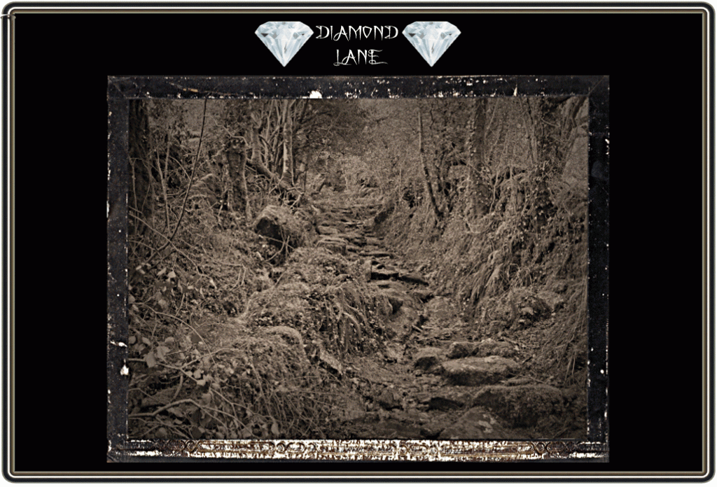
“… passing through a gateway makes a direct descent of the steep, rugged and often very wet Diamond Lane. (This part of the route must surely have called into question the physical fitness of pedestrian monks as well at the surefootedness of palfreys and packhorses!). – Hemery, p.187.
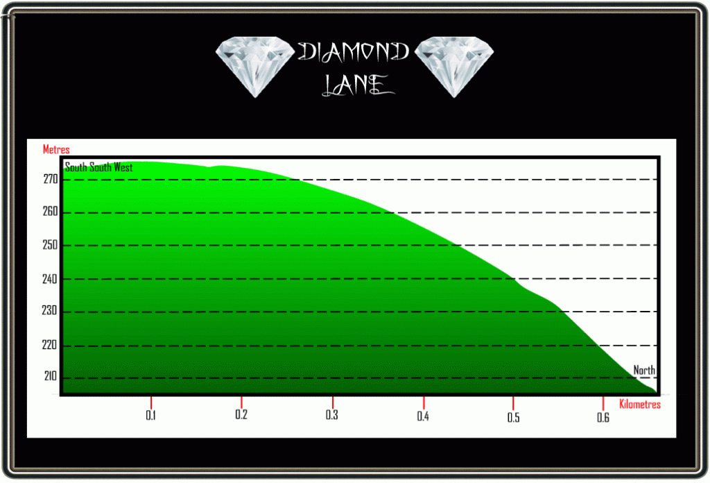
As can be gathered from Hemery’s words Diamond Lane is ancient and as anyone who has ascended it will testify quite steep as it rises some 70 metres over the course of around 600m. Throughout time this lane would have been a busy thoroughfare carrying the feet of many people and the hooves of numerous horses and ponies as they made there way to and from Brent Moor. Way back in the murky mists of time Diamond Lane was part of the ancient monastic track which carried monks and in some cases their burden to and from Buckfast Abbey to Plympton Priory. When walking up or down Diamond Lane one really gets a sense of strolling back through time as you carefully pick your way through the old rocks and boulders which have been worn by the tread of foot and hoof. The moss draped dry stone walls which in some places are sheltered by the overhead canopy of gnarled trees seem to whisper tales of those who have gone before. Although judging from the plethora of prehistoric monuments located around the area at the head of the lane it’s quite possible that it was used as far back as Neolithic times. One early newspaper report of 1906 stated that; “This path, which is very rugged, forms part of an ancient track, long since disused, though local tradition states that there was once considerable traffic over it. Near where it enters the common is a large stone hollowed out in the manner of a trough, which according to the country people was placed there for passing ponies and cattle to drink from. But that this could not have been the case is shown by the fact that there are no means of supplying it with water; nor would a drinking trough be necessary at such a spot, for the Avon flows near the bottom of the lane and there animals could be conveniently watered. It is clear that the intention was to remove the trough when completed but for some reason it was left unfinished.” It was once rumoured that at some point in time a coach and four was driven along Diamond Lane, Crossing, 1987, p.174, however as with many such tales this seems rather unlikely.
Due to its moor edge location Diamond Lane has always suffered from excess water running off the moor and the erosion it has caused posing a serious threat to travellers and animals. On the 10th of February 1865 The Exeter & Plymouth Gazette stated how at a meeting of the Highway Board: “The Clerk read a letter from Capt. Woodley, R. N., of Didworthy, complaining of the state of ‘Diamond Lane,’ in that parish, which was impassable, and during heavy rains the water washed down it like a river… As it appeared that the lane had never been repaired by the parish the board resolved not to undertake the work.” However by the 21st of April, 1883, some restoration work had been carried out as the secretary of the Dartmoor Preservation Association announced that diamond Lane had been restored and was open to horse traffic. There can be no doubt that numerous attempts at repairing the lane have been carried out with the most recent one in 2011. As part of the Dartmoor National Park’s 60th anniversary various community projects were arranged, one being an extensive programme of maintenance work on Diamond Lane. Two stages of the project were implemented the first being filling in, re-surfacing and improving the drainage of the bottom section of the lane. The second stage involved large scale drainage work on the top of the route. With the aid of a digger further drainage work which limited the volume of water flowing down the lane was carried out along with clearing out the various cross drains in the track. once again in the October of 2018 more volunteer work was carried out on the lane, this time to once more clear the drainage
With such an ancient track it should come a no surprise and William Crossing tells us how; “Lady Howard’s coach of bones in which she used to ride to the moor; a coach and four stated by tradition to have been driven up Diamond Lane, a narrow way leading to the commons in the parish of Brent.” – p.133.

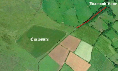
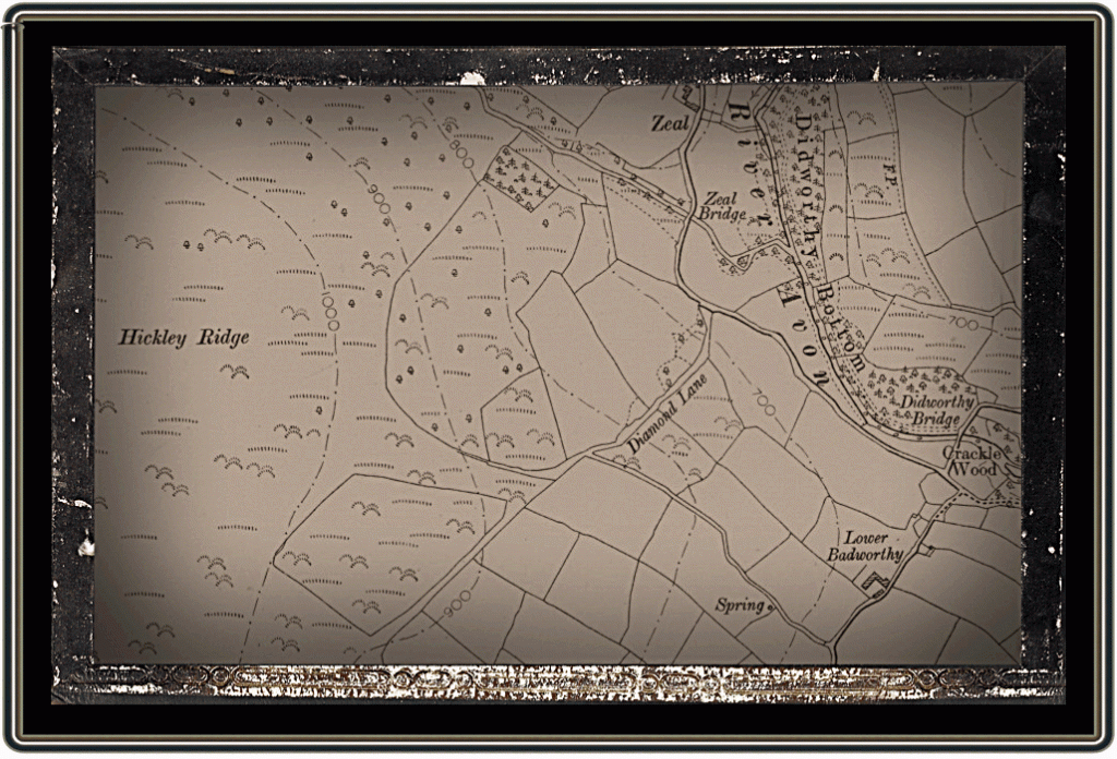
Finally there is one enigmatic question – how did Diamond Lane get its name? Quiet frankly I have no idea but I have two suggestions; firstly did it relate to a personal name of somebody who often used the track such as ‘Diamond’ or a dialect mutation of that name into ‘Dymond’? Secondly, is there any relation to the rough ‘diamond’ shaped enclosure which sits on the open moor just at the head of the lane? On the tithe apportionment map of 1841 this nine acre enclosure belonging to Higher Badworthy Farm is simply called ‘newtake’ so no clue is given here. Likewise on the same map Diamond Lane is just called ‘road’ and comes under the auspices of Lower Bradworthy Farm. And by the way, for some odd reason the Ordnance Survey folk despite showing the lane no longer name it which for such an ancient part of a trackway is odd. For those looking for Diamond Land its lower end starts at OS grid Ref. SX 6793 6231 and terminates at SX 6777 6209 before entering the open moor.
 Crossing, W. 1966. Crossing’s Dartmoor Worker. Newton Abbot: David & Charles.
Crossing, W. 1987. The Ancient Stone Crosses of Dartmoor. Exeter: Devon Books.
Hemery, E. 1986. Walking Dartmoor’s Ancient Tracks. London: Robert Hale.
 Legendary Dartmoor The many aspects past and present of Dartmoor


