Legendary Dartmoor The many aspects past and present of Dartmoor


Please note access to the mine and its surrounds are by prior appointment only as the land is privately owned.
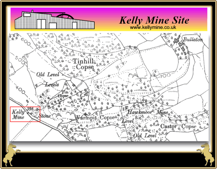
The chosen route for our first full day’s walk during the Easter break was from Trenchaford Reservoir, down past Bullaton Farm and then onto the Kelly Mine via the steep track that leads down between Warmpit Copse and Tinhill Copse. However, a much easier way to get to the mine is by a direct entry from beside the A382 Bovey Tracy to Moretonhamstead road. As noted above, the Kelly Mine Preservation Society always prefer for folk to pre- arrange their visits before arriving. The mine is normally open on Wednesdays and Sundays, and to arrange a visit simply telephone the secretary, Nick Walter on 01626 843127. The KMPS also hold a bi-annual open day when some of the machinery is actually working and their volunteers are on site to guide people around, the next open day will provisionally be held on September the 4th 2016.
To write anything about Kelly Mine that would do it justice would either take a book or an entire website written by an expert on mines and mining. I know very little about mines and mining and as yet no book has been written. However, the KMPS have a brilliant website with lots of information about the mine including the geology of the area, the history of the mine, how the ore was extracted and then processed and much more. All this can be found on the following link; The Kelly Mine Preservation Society Website. So this webpage is basically recounting our visit to the mine and the experiences we had.
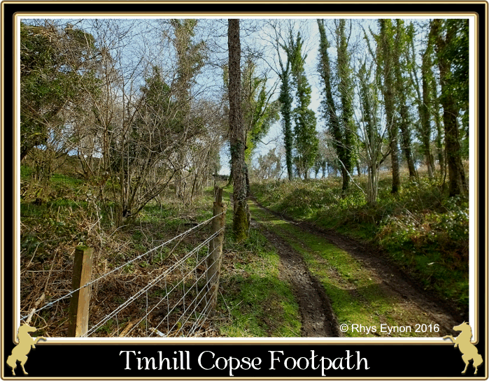
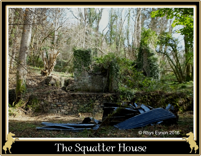
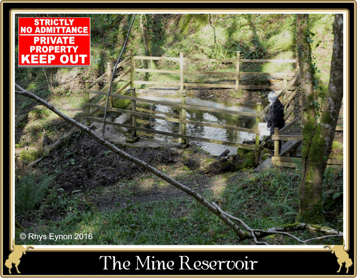
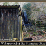
As mentioned on the Bullaton Farm page we had been gifted with a perfect Spring morning fresh, crisp and with blue skies. I say we which was the usual gang; Angela, Louise, Holly Rhys and myself. When we first entered the woodland footpath we were standing at an altitude of about 232 metres and having walked 530 metres we were standing in the mine at 110 metres so as noted above it is a steep descent. What concerned me more was the impending ascent back up to Trenchaford but more about that later. The woods were full of birdsong with rays of sunlight bursting through the trees and spotlighting the early Spring primroses. I would image a few weeks later the woodland floor would be carpeted with bluebells, sadly they had not flowered on that occasion. The first sign of human activity was the shell of a derelict building which seemed to be in the middle of nowhere. We all agreed that it would be an ideal spot to live and assumed that it must have been associated with the mine somehow. We were later to learn that in recent times a squatter lived in the house, and cleared many of the trees in order to get a good view of the nearby railway station at Lustleigh. One might think that an odd thing to do but there was method in his madness. When the mail train arrived he would at the appointed hour look down to the station, if there was mail for him one of the station workers would wave a green flag, if there was no mail it would be a red flag. This saved him a fruitless journey down to Lustleigh. A short distance down from the ruin we came across a reservoir which clearly was associated with the mine, again this is on private property with no public access. This reservoir had been recently restored by the KMPS and at one time would and in fact still does collect water to drive the various waterwheels and machinery. It was clear at this point we were nearing the mine and so continued down, following various pipes, leats and launders until we reached the mine’s main buildings.
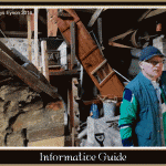
Having arrived at the mine and had a mooch around the various buildings which at the time were deserted it was decided that this was the ideal spot for a coffee break but just as we were about to settle down a gentleman appeared. At first he seemed none too happy with his uninvited guests but having explained why we were there he very kindly offered us a guided tour. In our defence I must say that the KMPS website does state; “Kelly Mine is open and visitors are very welcome to drop in“, which is precisely what we did. However, as noted above, to get the best visitor experience it’s always best to pre-arrange a visit. It was soon clear that thanks to great deal of hard work from the dedicated volunteers and members of the group a lot of of painstaking restoration has been achieved. Their funding has come from membership fees of the society, donations and various grants and awards.
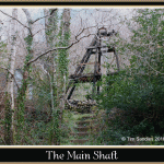
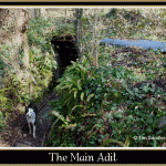
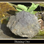
OK, in a nutshell what, when and why? The first recorded activity at the mine was in 1797 when it was worked for micaceous haematite or more locally ‘Shining Ore’. In the 17th and 18th centuries this was used to make ‘Devon Sand’ or Pounce which an early form of blotting paper that would absorb the ink on written documents. It was also used to produce a glaze for a type of pottery known as ‘Sparkle Ware’, tiles and bricks. If you are wondering why the ore is known as ‘shining ore’ then a visit to this mine or any other micaceous haematite mine will soon show you why. Many years ago a group of us explored down the nearby abandoned ‘shining ore’ mine known as ‘Great Rock’, I would say it took around a week to get all the minuscule shiny particles of ore out of our clothes, hair and skin, I resembled something like a sparkling Christmas decoration for ages afterwards. That aside and getting back to Kelly Mine, The first official record of the mine comes in 1877 when it was reported that 3 men were producing around 25 tons of ore a year. The mine was then worked on and off right up until 1951 when an explosion caused a mighty collapse and work stopped for good. This left the owners owing money to the landowner which they could not repay and so everything was just left on site and the mine abandoned. Then in 1987 with the cooperation of the landowner the KMSP began their work to restore the mine thus saving one of Dartmoor’s key heritage sites. As far as I know this is the only mine on Dartmoor where it is possible to safely visit and see so much of the original machinery, tools, etc. That is why the work of the KMPS is so important to the industrial mining history of Dartmoor.
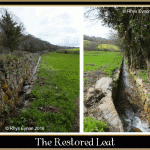
As mentioned above there is so much more that can be said about the mine and the place to see that is on the KMPS website thus negating the need for repetition here. Below are just a few further photographs taken on our visit to give a flavour of what is to be seen. However, if we thought it ended there we were to be pleasantly surprised because after our tour we were taken to see other work that the volunteers are doing. You would never realise that across the road and behind the wall is a fully restored leat. At one time the excess water from the mine ran through a culvert under the road and along with the leat became silted up. This meant what water did flow out simply ran down into the field thus creating a small, reed filled streamlet. As you can see from the photograph below the KMPS volunteers have now completely cleared both the culvert and the leat. So now the water flows from the mine, along the leat in an ‘L’ shape and eventually empties into the Wray Brook. The unanswered question at the moment is why the leat takes such a strange course; exit the mine take a 90º turn alongside the road then another 90º turn to run alongside the Kelly Farm enclosures? It’s course can clearly be seen on the 1:25,000 OS Explorer map which for some odd reason also shows another watercourse running parallel to it? Firstly I must apologise for not remembering the name of our very helpful and knowledgeable guide for the day, but if ever he reads this a big thank you for us all for giving up your time to show us around. This also goes to the two other gentlemen who showed us the restored leat.

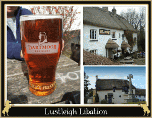
Our tour of the mine was so engrossing we lost track of time and had to be hauled away by the ladies who had not been on the tour and were coffeed out. Now as I said before the return route back to the car was back up the Everest-like ascent of the woodland footpath. I am ashamed to say that due to a pair of Dartmoor eroded knees, too many Marlborough, not enough previous exercise and a general over consumption of beer I chickened out. It was arranged that everyone else would go back to the cars and I would make my way across to Lustleigh were we would all rendezvous at The Cleave Inn. Apparently there was a public footpath which followed the restored leat, crossed a few fields and then meandered into Lustleigh. Well, the first bit was straight forward enough but after crossing a small stream and walking up a field and across a stile I found myself in a swap the Everglades would be proud of. Having no map I got out the trusty mobile with my Outdoors OS map app to see exactly where the footpath went. But for some reason I had not downloaded it onto the new phone so the next course of action was to slosh out into the swamp whilst taking care to avoid the alligators. Having got halfway I couldn’t see any exit so I returned to the stile to have a rethink. As luck would have it I saw a man sloshing across the swamp towards me who it transpires was another volunteer at the Kelly Mine on his way to work. Thankfully he confirmed there was a small gateway at the far end of the swamp which gave access to Lustleigh. A short while afterwards we were all reunited at the pub and enjoying an excellent pint in the beer garden – the perfect end to a perfect day.