The nice things with place-names is that you can play around with them in all sorts of ‘sad’ ways. In this light, it is possible to make up an entire suit of Dartmoor playing cards from some of the old and modern place-names to be found on the moor. I am not sure how many other national parks this can be said of but Dartmoor certainly is one of them – just! So in ascending order I will deal you out the ‘Dartmoor Suit of Cards’:
| |
THE TWO OF DARTMOORS |
Two Brothers Adit – SX 59103 68273.
This is an entrance to a shaft belonging to the Eylesbarrow Mine. In 1823 this mine was one of the few still working on Dartmoor it also had the distinction of owning its own smelting house where in 1824 100 blocks of tin were coined. Due to the low price of tin, mining operations were suspended in 1844 but were resumed again 1847 when Two Brothers Adit was being cleared. The manager noted that the deep adit driven by the old adventurers had been cleared 600 fathoms from its mouth.

Yours Truly in Two Brother’s Adit
This adit has been the location for several letterboxes and I am told been unofficially cleared out to allow access. One feature of the adit is the ‘Chocolate Orange’ which is a huge circular boulder that was placed over an old shaft to seal it. From below you have to crawl beneath this precariously placed rock to gain access to the mine and if you look up you can see chinks of daylight piercing the darkness where the shaft is not completely sealed.
Please note ALL the letterboxes have now been removed and it is highly dangerous if not forbidden to enter any old mine on Dartmoor.
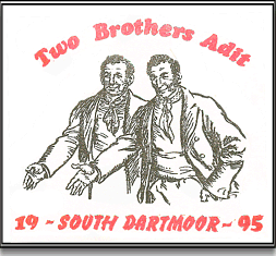
Letterbox stamp – Two Brothers
| |
THE THREE OF DARTMOORS |
Three Boys – SX 66028 85496
This is actually marked on the 2005 1:25,000 OS map and sadly they have got it wrong again as there is only ‘One Boy’ left. It is the prone relic of a stone row and originally there were three, possibly terminal stones. Worth reported that the other two fell victim to the despoilers and were taken and used as gateposts in the nearby Thornworthy newtake sometime prior to 1858. Originally it was though that the Three Boys were the supporting stones for a Dolmen.
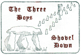
Letterbox Stamp – The Three Boys
| |
THE FOUR OF DARTMOORS |
Four Winds – SX56067 74878
This is one of the more evocative names on Dartmoor and conjures up images of an isolated, bleak and desolate spot that is open to the ‘Four Winds’. It may be open to the winds but it is far from remote as it is literally beside the B3357 Princetown to Tavistock road. Look beyond the present and find the past, in this case you will see a car park and some ruins which at one time were a bustling school where children from the nearby Foggintor Quarry attended.
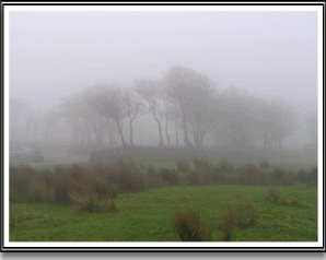
A ‘foggy’ Four Winds
| |
THE FIVE OF DARTMOORS |
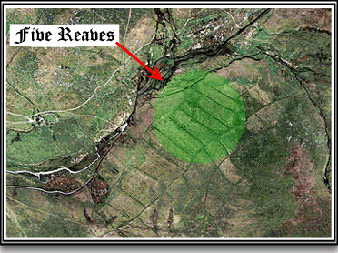
Five Reaves – SX 590 662
During the Napoleonic wars the need for extra food meant previously cropped land was turned to arable use. Realising the potential for profit Peter Nicholl’s was recorded as taking “five pairs of oxen and his man” to plough up the flanks of Shavercombe Hill. The results of this can still be seen from aerial photographs as he used prehistoric reaves as the boundaries for his strip fields and the area is known as ‘Five Reaves’.
| |
THE SIX OF DARTMOORS |
OP 6 – SX 60285 89853
Six is the only one that needs a modicum of poetic licence as it is the only number without and exact place-name therefore in this instance it is represented by Observation Post 6 which is a military look-out point on the Okehampton firing range. It is marked on the OS 1:25,000 map but not actually named, unlike many of its counterparts this one has not been removed and is still in use.
| |
THE SEVEN OF DARTMOORS |
Seven Stones – SX67513 78696
The Seven Stones is a prehistoric stone circle and kist. The stones are also a point on the old Saxon boundary of the Bishop of Paignton lands. Pre-Christian burials were often used as boundary points and the Saxon term for them was often ‘Seven Stones’. They once also marked a point on the Spitchwick Manor bounds in the 16th century where they were called the ‘Ring O’ Stones’ or ‘Ringastan’.

The Seven Stones
| |
THE EIGHT OF DARTMOORS |
Eight Rocks – SX 63??? 93???
The ‘Eight Rocks’ were a prehistoric stone circle or row that stood on the northern end of Cosdon. William Crossing tends to think they were a stone row whilst St. Leger-Gordon states they were a stone circle. Either way the monument was despoiled to help make an enclosure wall. There was a local legend that when the ‘Eight Rocks’ heard the sound of South Tawton church bells they could be seen to dance.
Letterbox Stamp – Eight Rocks
| |
THE NINE OF DARTMOORS |
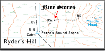
Nine Stones – SX66195 69215
This is in fact a boundstone which marks the Buckfastleigh and Holne parish boundary. It is located near an old tinner’s reservoir and consists of a single rough set stone inscribed with the letter ‘H’.
| |
THE TEN OF DARTMOORS |
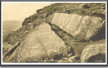
Ten Commandments – SX73503 73108
A boulder located on Buckland Beacon which has the Ten Commandments inscribed on it. The work was commissioned by Mr W. Whiteley and carried out by Mr W. A. Clement who for obvious reasons later became known as ‘Moses’ Clement – see The Ten Commandments.
Old postcard of The Ten Commandments
| |
THE JACK OF DARTMOORS |
Old Jack – SX 76883 78088
This old fellow is in fact a boundary stone which marks the bounds of the Islington and Bovey Tracey parish bounds. A stone was recorded in 1835 but it was thought to have been a natural rock. In 1853 it was noted that the stone had been removed but it was ordered to be replaced. The stone now standing is inscribed “Old Jack”. It was off and around this boundstone that celebratory letterboxes were sited in 1999 for the 80th birthday of the ‘godfather of letterboxing’ – Godfrey Swinscow.
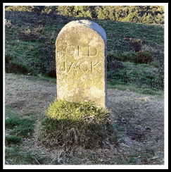
Old Jack – Photo R. Knight
| |
THE QUEEN OF DARTMOORS |
Queen Victoria’s Cross – SX6561 7262
This cross was erected in 1897 to commemorate Queen Victoria’s Diamond Jubilee. On its western face it has inscribed “VR – 1837 – 1897 – Also to the glory of God – in commemoration of the – 60 years of – Queen Victoria’s reign.” The granite for the cross came from Duke’s quarry at Merrivale and it stands at 2.32 metres with a north south alignment. The cross is the only Celtic design cross to be found anywhere on Dartmoor excepting church yards and cemeteries.
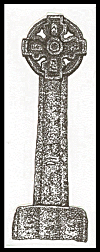
Queen Victoria’s
Cross
| |
THE KING OF DARTMOORS |
King’s Oven – SX 67473 81296
The King’s Oven is a cairn on the summit of Water Hill and was a point on the 1240 perambulation or survey of the bounds of the Forest of Dartmoor where it was stated “et inde linealiter usque ad Furnum Regis.” It was thought that maybe this was the site of a tin smelting house as they were often called ‘King’s Ovens’ but latter thinking now considers the King’s Oven to be the actual remains of the prehistoric cairn. There is also a tradition that the name refers a one time chair and oven that belonged to King Arthur.
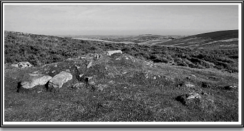
The King’s Oven
| |
THE ACE OF DARTMOORS |
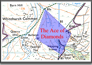
Ace of Diamonds – SX538 745
The ‘Ace of Diamonds’ is an old place-name for the area outlined by four stones that mark the Samford Spiney and Whitchurch bounds. The name has also been ascribed as a local name for the common on which they stand.
 Legendary Dartmoor The many aspects past and present of Dartmoor
