 Legendary Dartmoor The many aspects past and present of Dartmoor

I don’t know why I’m doing this page apart from the fact that Riddon Ridge holds that something special, can’t say what it is but there is some magnetic draw there for me. Oh, and all the various relics from times gone by that can be found there. Even the name sounds exciting, it could well be a location in a Western movie or perhaps the name of some historic hero. But I am not the only one to find something special there for dotted around the ridge are the remains of folk who made it their home some 2,500 years ago. Not only did they live on the ridge but they buried their dead on there as well. English Heritage considers that:
“The irregular aggregate field systems on Riddon Ridge are amongst the most extensive recorded on Dartmoor. Their relationship with the Dartmeet coaxial field system is of particular interest. The settlements and cairns provide useful information on the character of occupation in this area during the Bronze Age and together with the other Bronze Age remains, this monument represents an important and relatively rare instance of an area containing good examples of the major settlement and land division types found on the Moor. Historic activity within the same area provides a useful insight into its continuing use.”, on-line source.
As always let’s begin with the place-name Riddon, the earliest documented record of the name comes from the Duchy of Cornwall in 1488 when it appears as it does today. It has gone through a few mutations before arriving back to its original state. Glover et. al. suggest that the place-name consists of two elements; ridde and dun the second meaning ‘hill’ and the first ‘rid’ or ‘clear’ thus giving a hill that has been cleared of undergrowth, p.198.

Just maybe another possible meaning would be that the ‘ridd‘ element has undergone a dialect mutation and refers to the colour ‘red’, suggestive of the heather’s hue. The dun would still be hill which would then give the ‘Red Hill’? On a map published by Samuel Rowe in 1848 he marks the lower section of Riddon Ridge as ‘Redridge Down‘, yet again the ‘red’ element appears. Either way, the names all refer to the ancient tenement of Riddon which although is first documented in 1488 could well be much older. One more place-name to conjure with, the southern end of Riddon Ridge is also known as Mill Hill. This is due to the fact that it overlooked the location of the old mill at Babeny.
Riddon Ridge covers an area of about 250 hectares of unenclosed moorland whose highest point sits at a respectable 380 metres. To the east of the ridge flows the Wallabrook, to the west the East Dart river, to the north lies the ancient tenement and enclosures of Pizwell and to the south the ancient tenement of Babeny along with its enclosures. So basically you have an ‘island’ enclosed on two sides by water and the other two sides by human occupation.
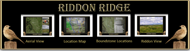
Riddon Ridge still retains numerous elements of past prehistoric, medieval, and post-medieval times. As far as the prehistoric features go there is evidence of a reave system, enclosures, hut circles and cairns. In the June of 1913 Robert Burnard instigated an ‘investigation‘ into the cairn which lies on the eastern slope of the ridge. It was found that the tomb raiders had previously ‘investigated’ it as well but they did recover a small ‘vase’ along with pot sherds, a flint flake, some pieces of quartz and a large amount of wood charcoal, TDA, p.94. This assemblage is indicative of burial goods pertaining to the Bronze Age period and their ritual practices.
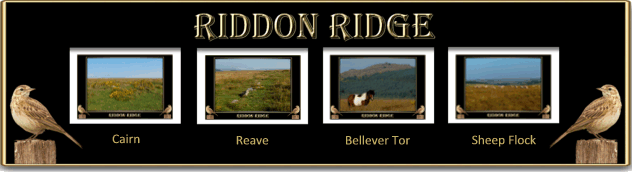
Moving forward to the medieval period when the landscape features are dominated by various field systems along with their associated ridge and furrows. At the very southern end of the ridge are the remains of what is thought to be a medieval chapel that sits in an enclosure called ‘Lady Mead Meadow’.
With regards to tinning activities there is evidence of stream works and exploratory tin pits, these cover both the medieval and post-medieval periods. The post-medieval period is represented by later field enclosures, newtakes, dwellings and boundstones.
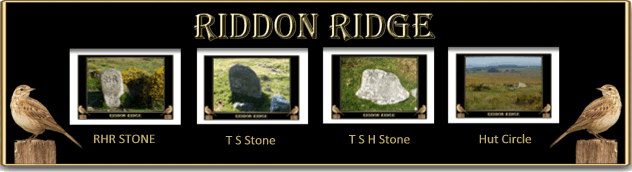
These various boundstones are dotted on and around the ridge, all inscribed with various initials. Initially there were though to have been seven such stones in-situ on the ridge, however in 1999 another two were found. In the following year yet another was discovered bringing the total to nine stones. The letters consisted of RHR, TS/H, TSH/RHR, TS/K, TS/II (the ‘II’ could possibly be an ‘H’) and FS/H (again the ‘F’ could be a ‘T’). Initially they were thought to be tinner’s stones which marked out the limits of their setts. However, this has now been proven to be not so and they do in fact refer to one Thomas Smeardon, one Robert Henry Roberts (Babeny) and one Kivill (Babeny). One suggestion to the purpose of the stones was to delineate the areas where the Duchy of Cornwall granted permission to the tenants of Whiteslade to cut peat or vags, Brewer, pp. 218 – 283.
There is one final stone which is no longer in-situ which can be found leaning against the walls of the Snailey House and is simply inscribed with the letters SL which refer to the Reverend Samuel Lane. It is unknown as to exactly where the stone originated from thus no further information although it is known he was a tenant at Babeny.
A careful look about thirty metres south of the large hut circle (SX 6662 7663) is a flat, triangular rock that has an cross incised on it. It could well be that this cross marked a route which led from the ancient tenement of Riddon and joined the Lychway at Bellever? Sadly on my visit and despite much tortuous tramping through leg scraping gorse and ankle twisting tussocks I could not find it – probably because I forgot to take the grid reference for it. Thanks to Dave Hamnett’s directions it can be found; “ NE of the hut circle (about 50m), at SX 66638 76666, 363m.”
On the lower south western slopes of Riddon Ridge are the ruins of Whiteslade which today is also known as the Snailey House. It acquired this name thanks to two women who once dwelt there and lived on a diet consisting of slugs, more of which – HERE.
As noted above, the first documented evidence for the tenement of Riddon was in 1488 and over the centuries has been tenanted by various families; Hammett (1702), French (1730), Mann (early 1800s) and Norrish (1980s), Hemery, p.523.
I was watching a Time Team special where one of the archaeologists was walking the Dorset Ridgeway and experimenting with ‘phenomenology‘. Which I always thought it was the study of lumps and bumps on your head but there we go. One dictionary describes this as being; “a philosophical movement that describes the formal structure of the objects awareness and of awareness itself in an abstraction from any claims concerning existence.” And if you understand that lot then you be a better man (or woman) than I Gungadin, so lets try again. In a nutshell and in this context it is being in a place and trying to see it through the eyes of those living at any time of history related to the visible landscape features – sort of. Try again, it is walking in a landscape and using all your senses to view a natural and cultural landscape as people in the past would have done – that’s better.
Anyway, I thought I’d give it a try on Riddon Ridge… the year is 2014 BC and the first thing I don’t see is the road coming up from Bellever that crosses the bridge and heads uphill. What I do see is the river and a worn track leading to a convenient crossing place that then cuts up onto the ridge.
On walking along the ridge-line I see the stone studded reave systems which today are described as being the western edge boundary of the Dartmeet Parallel System. You can also imagine that in the various defined enclosures sheep flocks quietly graze on the moor grasses. There are extensive panoramic views stretching over to Bellever and Laughter tors to the west and their associated ritual monuments. To the east rolls the mighty whale-back ridge of Hambledon where clearly visible are some ancestral granite tombs. Northwards the dome of Assycombe Hill rises majestically into the clouds, it is here that the lands of the neighbouring tribe begin. On reaching the highest point of the ridge the huge, gleaming pile of stones indicate where the last resting place of the tribe’s elder lies. It is a statement that these lands belong to the tribe as well as denoting the burial place of respected chieftain. Scattered around the edges of the cairn are the charcoal remains from various feasting fires. Sitting by the cairn and viewing the landscape you see not only an agricultural landscape but a highly ritualised and sacred one.
From the cairn wander back northwards and a small settlement of huts and associated enclosures appears. Just below the ridgeline sits the largest of the hut circles, peeping its head up from its sheltered hollow. This dwelling is by far larger than any others on and around the ridge and is the home of the present chieftain. Nicely tucked into the slope the hut is protected from the south-west winds and provided with a splendid vista to the east. Step inside and you can almost see the hustle and bustle of daily life. Certainly on this occasion the soundscape would virtually be identical to what it was then, the only sounds being the bleating of the sheep, lowing of the cattle and the birdsong in the air. Question – why build the dwelling here? If it did belong to the tribal chieftain his position would demand seclusion from his neighbours. It has a nearby(ish) water source, it’s sheltered and has a view that today would be worth thousands of pounds. Dotted around the settlement are more burial cairns, reminders of long departed ancestors.
So ‘phenomenologically‘ speaking, take away all the modern-day conifer plantations, fields, walls, dwellings, the yellow butter spread of gorse and roads and its not hard to picture the prehistoric landscape. But then again this can be applied to almost anywhere on upland Dartmoor. And if I’m honest, although this concept has a fancy name I reckon it’s what all Dartmoor walkers do anyway except we call it enjoying our walks.
One fond memory I have of Riddon Ridge dates back to 2005, at this time I was running an archaeology club for the primary children at my wife’s school. We decided that it was about time they saw Dartmoor and so stayed at Bellever Youth Hostel. We took them up on Riddon Ridge to explore the landscape features whilst introducing them to Dartmoor Letterboxing. More of the trip – HERE.
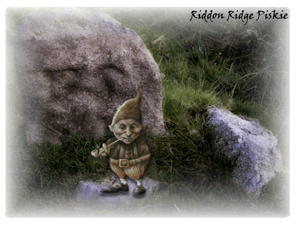
Oh, by the way, should anyone be interested in a spot of ‘Piskie Peeking‘ then the noted folklorist Theo Brown reliably states that Riddon Ridge is a likely place to spot a few. Below is a photo of one I found at the ‘TS’ stone, more of a cheerful chappie you could wish to meet.
Seeing is believing

Brewer, D. 2002. Dartmoor Boundary Markers. Tiverton: Halsgrove Publishing.
Burnard, R. 1914 Thirty Third Report of the Barrow Committee – Transactions of the Devonshire Association – Vol. XLVI. Plymouth: W. Brendon & Son.
Gover, J. E. B., Mawer, A. & Stenton, F.M. 1992 The Place-Names of Devon. Nottingham: The English Place-Name Society.
Hemery, E. 1983. High Dartmoor. London: Robert Hale.
Looking at your Riddon Ridge Boundary Stone map (photo), which includes the grid references, there seems to be some difference between where you place the pins and the grid refs that you list.
e.g. SX 6713 7221 (FS/H)
Very confusing.